 Skip to content


DJI Matrice 400
£10,650.00
- Up to 59-minute flight endurance
- Rotating LiDAR & mmWave radar sensing
- Supports H30, L2 & P1 payloads
- O4 Enterprise transmission with RC Plus
- Rugged, UK-ready inspection design
DJI Matrice 400 (M400) — Endurance, Sensing & Payload Flexibility
The DJI Matrice 400 is a next-generation enterprise platform for UK organisations that need long endurance,
superior obstacle sensing and a powerful payload ecosystem. From infrastructure inspections and utilities to mapping and public safety,
the M400 delivers up to ~59 minutes of flight time, robust all-weather design, and support for multi-sensor payloads
such as H30/H30T, Zenmuse L2 LiDAR and the P1 photogrammetry camera.
Multi-payload (up to 7 mounts)
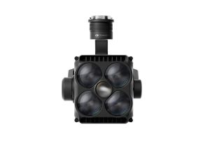
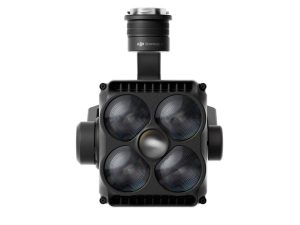
Rotating LiDAR + mmWave radar sensing
O4 Enterprise link
RC Plus controller
Cover More in a Single LiftMaximise time on task with long-endurance flights and a high payload capacity that supports advanced sensors
|  |
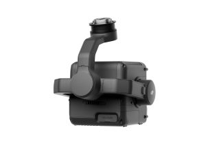
 | Advanced Obstacle SensingThe M400 combines rotating LiDAR with mmWave radar for high-fidelity environment perception,
|

One Platform, Many Jobs
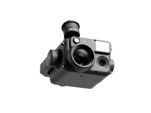
Swap payloads to match the task: H30/H30T for long-range visual/thermal,
Zenmuse L2 for survey-grade LiDAR, and P1 for high-accuracy photogrammetry.
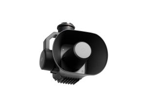
Accessories like Zenmuse S1 spotlight and V1 loudspeaker expand
night ops and on-scene communications.
- Rapid payload changes
- Multi-payload mounting options
- Supports third-party integrations
Explore payloads:
H30 Series ·
L2 ·
P1 ·
S1 ·
V1
 | Enterprise Link & RC PlusStay connected with the O4 Enterprise transmission system and the DJI RC Plus smart controller.
|
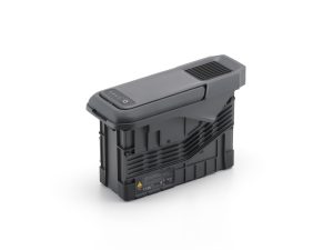
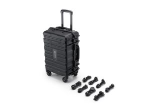
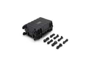
Field-Ready Power & TurnaroundsThe M400 power ecosystem supports fast swaps and high-throughput charging to keep operations moving.
|  |
Always operate within UK CAA rules and site permissions. Range/endurance vary with payload, conditions and mission profile.
Related Products
-


DJI M400 Surveying & Mapping Pro
£33,407.00 Buy Now -


DJI M400 Inspection & Infrastructure
£21,210.00 Buy Now -
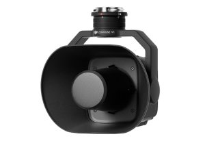
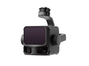
DJI Zenmuse H30
£3,880.00 Buy Now -
DJI Zenmuse S1
£1,100.00 Buy Now -
DJI Zenmuse V1
£810.00 Buy Now -
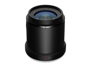
Zenmuse X7 DJI DL 24mm
£1,299.00 Buy Now -
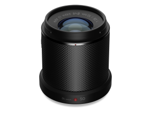
Zenmuse X7 DJI DL 50mm
£1,199.00 Buy Now -
TB100 Flight Battery
£1,320.00 Buy Now -
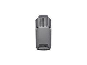
DJI BS100 Intelligent Battery Station
£1,150.00 Buy Now -
DJI Zenmuse L3
£13,150.00 Buy Now