


Drone Sales UK Case Study
Mapping 2,000 Acres with the DJI Mavic 3 Multispectral
A real-world look at how the DJI Mavic 3 Multispectral is being used for grassland monitoring, precision agriculture, vegetation analysis and data-led farming.
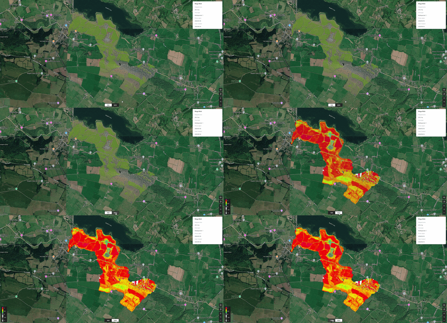
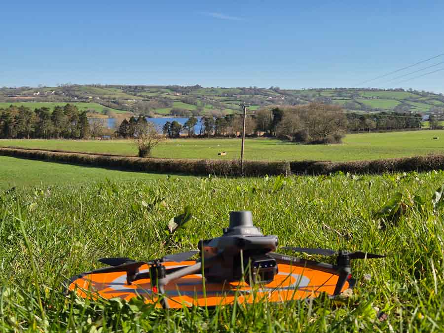
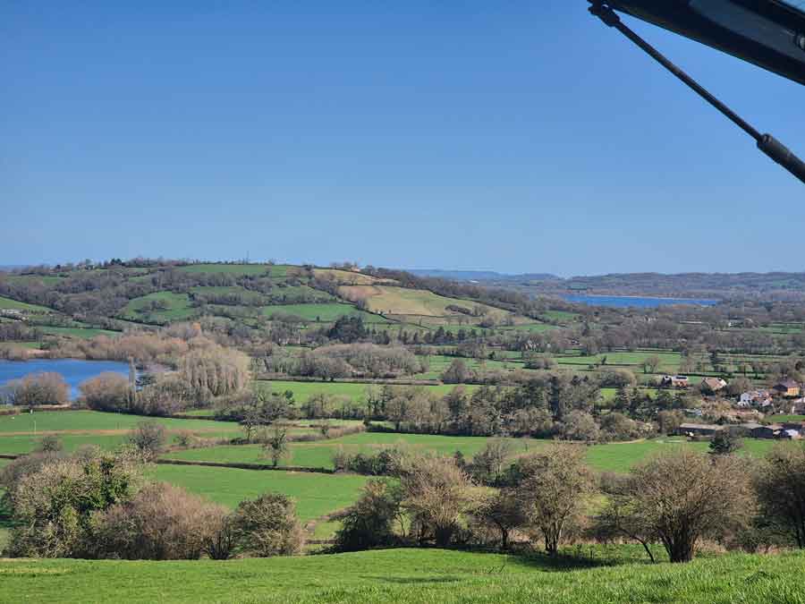
At Drone Sales UK, we recently completed a large-scale multispectral mapping project for Yeo Valley, capturing approximately 2,000 acres of grassland using the DJI Mavic 3 Multispectral.
The project gave us a valuable real-world opportunity to demonstrate the capability of the Mavic 3M across a serious agricultural environment. Over three days, flying between approximately 10am and 3pm each day, we captured high-resolution RGB and multispectral data across a significant area of productive grassland.
Batteries were cycled throughout the day using a DJI power station setup, allowing the team to maintain an efficient workflow and keep the aircraft operating with minimal downtime.
This was not simply a drone photography job. It was a data collection project designed to support modern agriculture, grassland monitoring and environmental insight.
Why the DJI Mavic 3 Multispectral?
The DJI Mavic 3 Multispectral, often referred to as the Mavic 3M, is designed for agricultural and environmental mapping. Unlike a standard camera drone, it combines a high-resolution RGB camera with four multispectral cameras capturing green, red, red edge and near-infrared bands.
This allows users to create vegetation index maps such as NDVI and NDRE, helping highlight differences in plant health, vigour, biomass and growth patterns that may not be visible in a normal RGB image.
20MP RGB Camera
Produces detailed visual maps and orthomosaics for field inspection and reporting.
4 Multispectral Bands
Captures green, red, red edge and near-infrared data for crop and grassland analysis.
RTK Positioning
Supports accurate, repeatable mapping missions over the same areas.
Portable Workflow
A compact folding platform suitable for farms, estates, research sites and contractors.
From RGB to NDVI: Seeing More Than the Human Eye
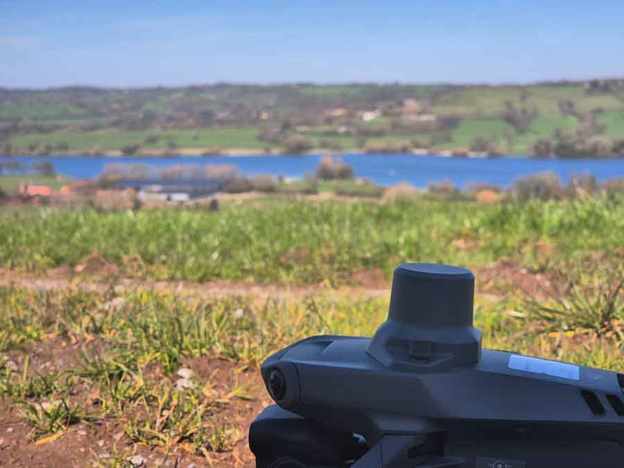
One of the most powerful aspects of the Mavic 3M is its ability to capture both standard RGB imagery and multispectral data in the same mission. The RGB orthomosaic provides a familiar visual overview of the land, while vegetation indices such as NDVI help reveal variation in plant vigour.
In grassland environments, this can be particularly useful. Areas that look broadly similar from the ground may show clear differences when viewed through multispectral data. These differences can support discussions around grass productivity, grazing performance, crop stress, drainage, soil variation and management decisions.
Grass Biomass, Carbon and Soil Health
During the planning discussions leading up to the project, the focus extended well beyond drones. Topics included grass biomass, soil health, carbon sequestration, regenerative farming and environmental monitoring.
It is important to be clear: a multispectral drone does not directly measure carbon in the soil. Soil carbon still requires appropriate ground sampling and analysis. However, drone data can play a valuable supporting role by mapping vegetation productivity and highlighting patterns across large areas.
When combined with ground measurements such as soil sampling, grass plate meter readings and transect surveys, multispectral imagery can help build a much richer picture of what is happening across a farm.
Simple explanation
The drone does not tell you how much carbon is in the soil. What it can do is help map vegetation health, vigour and productivity — key indicators that can support wider soil health and carbon monitoring programmes.
What Are Rising Plate Meters and Transects?
In grassland management, rising plate meters are commonly used to estimate grass biomass. They measure compressed grass height and help provide an indication of available forage. This is valuable for grazing management, silage planning and productivity monitoring.
Transects are another useful approach. A transect is a planned line across a field or landscape where repeated measurements can be taken at intervals. Researchers and land managers can then compare ground data with drone-derived maps, helping to validate what the imagery is showing.
This combination of ground truthing and aerial mapping is where the Mavic 3M becomes especially valuable. The aircraft can rapidly capture consistent data over large areas, while field measurements provide the physical evidence needed for deeper interpretation.
Processing with DJI SmartFarm
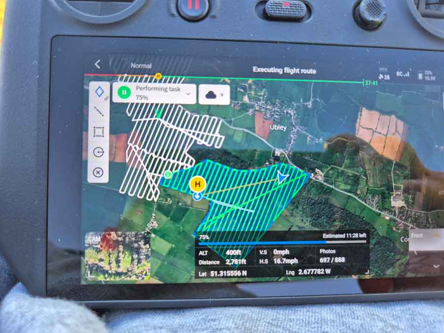
For this project, imagery was processed using DJI SmartFarm Web. DJI SmartFarm provides a cloud-based platform for agricultural mapping, allowing users to generate high-definition field imagery and analyse crop growth data.
For farmers, contractors and researchers, this type of workflow makes multispectral mapping more accessible. Flights can be planned and captured in the field, before the imagery is processed into useful visual outputs such as RGB maps and vegetation index layers.
Five Things We Learned from Mapping 2,000 Acres
- Large-scale multispectral mapping is achievable with the right planning. Covering 2,000 acres over three days required efficient battery cycling, sensible mission planning and good flying windows.
- Grassland mapping is more advanced than many people realise. The value is not just in pretty maps, but in supporting informed agricultural decisions.
- Multispectral data is strongest when combined with ground measurements. Plate meter readings, soil samples and transects can help validate what the drone is seeing.
- Repeatability matters. RTK-supported missions make it easier to return to the same areas and compare data over time.
- Precision agriculture is becoming increasingly data-led. Drones are now part of a much wider conversation around productivity, sustainability and environmental monitoring.
Who Is the DJI Mavic 3M For?
The DJI Mavic 3 Multispectral is a strong option for a wide range of users, including:
- Farmers wanting to monitor crop and grassland performance
- Agricultural contractors offering mapping services
- Research organisations and universities
- Environmental consultants
- Estate managers and landowners
- Regenerative agriculture projects
- Organisations monitoring vegetation change over time
Why Buy from Drone Sales UK?
At Drone Sales UK, we do more than simply supply the equipment. We use these systems in real-world environments and understand the practical challenges of planning missions, capturing reliable data and turning that data into useful outputs.
Whether you are looking to buy your first multispectral drone, expand your agricultural services or understand how drone mapping could support your business, our team can help advise on the right equipment and workflow.
Real Experience
We have used the Mavic 3M on large-scale agricultural mapping projects.
UK Support
Our team can support UK customers with advice, setup and workflow guidance.
Agricultural Focus
We understand the growing role of drones in UK agriculture and land management.
Explore DJI Multispectral Drones
If you are interested in bringing multispectral mapping into your own operation, explore our full range of multispectral drones, including the DJI Mavic 3 Multispectral.
You can also contact our team if you would like advice on the best setup for agriculture, environmental monitoring, research or commercial mapping.
Interested in Multispectral Mapping?
Speak to Drone Sales UK about the DJI Mavic 3 Multispectral and discover how drone mapping could support your farm, estate, research project or agricultural business.
View DJI Mavic 3 Multispectral Browse Multispectral Drones