


Drone Mapping for Contours, Drainage and Landscape Design
A professional drone mapping survey can provide much more than an aerial photograph. From one carefully planned flight, it is possible to create an accurate orthomosaic, elevation model, contour map, slope analysis and three-dimensional model of a site.
These outputs can then be used by different people for different purposes. A drainage specialist might use the elevation data to understand how water moves across the land, while a landscape designer can use the same contours to develop a design around the site’s existing topography.
A recent project involving a lake and its surrounding field demonstrated exactly how valuable a reusable drone mapping dataset can become.
The Original Requirement: Mapping the Land for Drainage
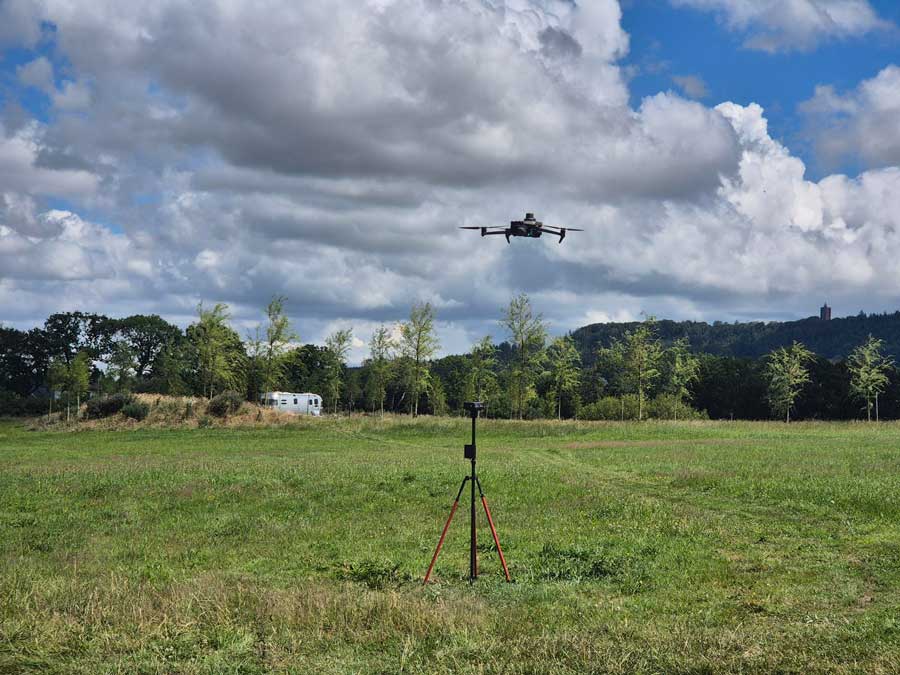
The project was originally commissioned to help investigate drainage around the lake and adjoining field. To understand the drainage properly, it was important to see more than the visible condition of the land. We needed to understand its shape.
Small changes in elevation can determine where rainwater travels, where it slows down and where it collects. These variations are not always obvious from ground-level observations, particularly across a large field.
Drone photogrammetry allowed the site to be recorded from above using a structured flight plan and a series of overlapping, accurately positioned images. Processing those images created several outputs from the same survey, including:
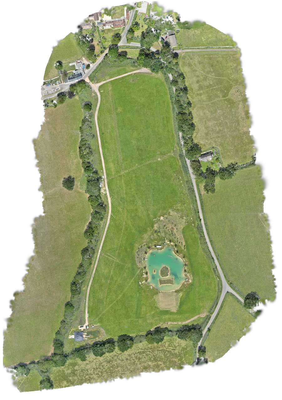
- A high-resolution aerial orthomosaic
- A digital surface and elevation model
- A colour-coded elevation map
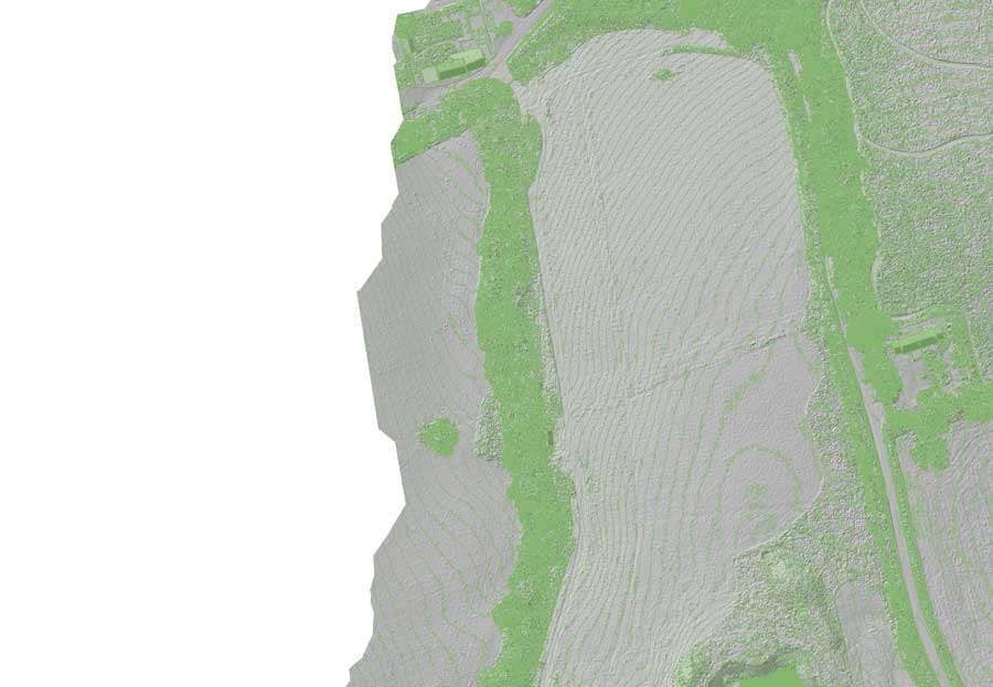
- A contour map
- Slope and hillshade visualisations
- A detailed 3D model of the field and surrounding area
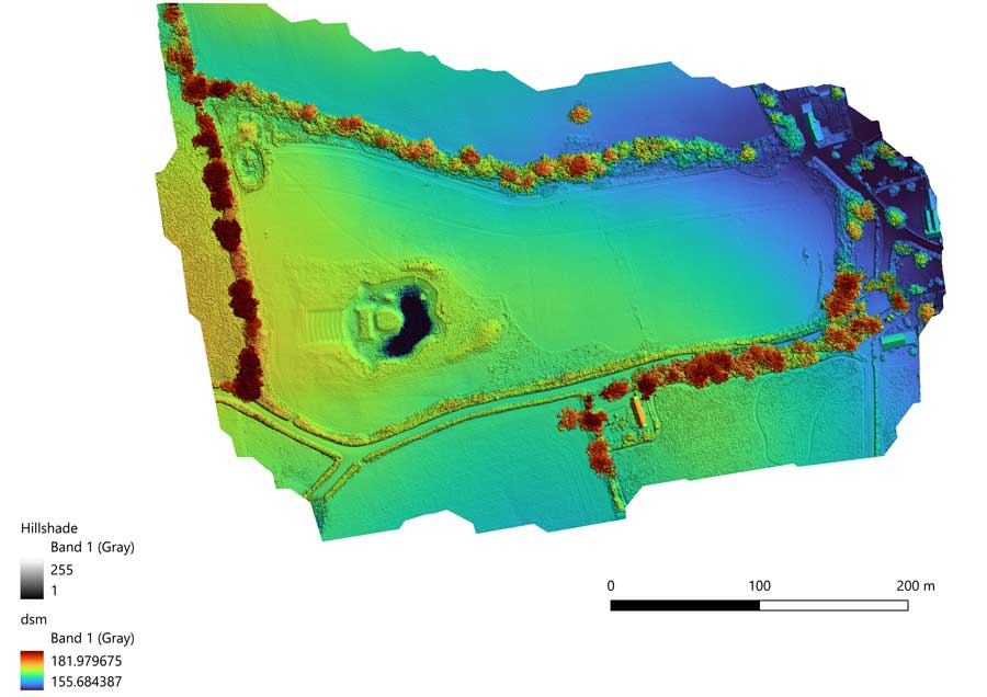
How Drone Contour Maps Help with Drainage Planning
A contour map connects points of equal elevation, turning complex terrain data into a plan that is relatively easy to read. Closely spaced contour lines normally indicate steeper ground, while wider spacing indicates a gentler gradient.
When planning drainage, this can help identify:
- The direction in which surface water is likely to travel
- Low points where water may collect
- Changes in gradient that could slow or redirect water
- Potential routes for swales, channels or land drains
- Areas where additional investigation may be required
- How drainage proposals connect with ponds, lakes and existing watercourses
The drone data does not replace the judgement of a qualified drainage engineer where formal design or engineering work is required. It does, however, provide a highly useful site-wide view from which drainage options can be investigated and discussed.
How Landscapers Can Use Drone-Generated Contour Maps
Following completion of the drainage work, the same contour map began to be used for the wider landscape design of the site.
For landscape designers, contours provide a valuable starting point because the design can be developed around the site’s actual levels. This is especially useful for larger gardens, estates, parks, golf courses, holiday parks and rural development projects where changes in height influence both the appearance and practicality of the finished scheme.
Landscape designers can use drone-generated contour and elevation information to help:
- Position paths and access routes on manageable gradients
- Plan terraces, steps, banks and retaining features
- Understand how planting areas relate to slopes and low-lying ground
- Consider visibility and sightlines across the site
- Integrate drainage into the overall landscape design
- Estimate where cut-and-fill work may be necessary
- Position features so they work with, rather than against, the natural terrain
Combining contours with a current aerial orthomosaic is particularly useful. The orthomosaic shows visible features such as boundaries, trees, tracks, buildings and water, while the contours add the elevation information that cannot be fully understood from the photograph alone.
This gives the landscaper a much more complete picture of the site before detailed design work begins.
Using a 3D Drone Model to Visualise an Amphitheatre
The project has since developed another use. The 3D model of the field is being provided to a designer who will use it to mock up a proposed amphitheatre at the top of the field.
Rather than visualising the amphitheatre on a generic or completely flat surface, the designer can work with a digital representation of the real terrain. This can help explore:
- The most appropriate position within the field
- How the seating might follow the natural slope
- The orientation of the performance area
- Views into and out of the proposed amphitheatre
- Access routes and connections with the wider landscape
- How the finished design may appear within its surroundings
A 3D site model can also make a concept much easier to communicate. Clients, designers and contractors can view the proposal in the context of the existing land rather than trying to interpret it solely from conventional plans.
Choosing a Drone for Contour and Terrain Mapping
The right mapping platform depends on the size and complexity of the site, the required outputs and whether the ground is open or covered by vegetation.
DJI Matrice 4E: A Compact Photogrammetry Platform
The DJI Matrice 4E is a compact enterprise drone designed specifically for mapping, surveying and visible-light inspection work.
Its 20 MP 4/3-inch camera uses a mechanical shutter, making it well suited to structured photogrammetry missions. Images captured during the flight can be processed into orthomosaics, point clouds, elevation models, contours and textured 3D models.
For landscapers, smaller surveying practices, construction companies and organisations carrying out regular mapping work, the Matrice 4E offers a portable route into professional drone photogrammetry.
DJI Matrice 400: LiDAR and Photogrammetry for Complex Sites
For larger sites and more demanding survey applications, the DJI M400 Surveying and Mapping Pro package combines the DJI Matrice 400 with both LiDAR and high-resolution photogrammetry capabilities.
The Zenmuse P1 can capture detailed imagery for orthomosaics, 3D meshes and visual site records. The Zenmuse L3 adds LiDAR data for generating point clouds and terrain information, including sites where trees, scrub or other vegetation make it harder for photogrammetry alone to represent the ground beneath.
This makes the M400 package particularly relevant to professional surveyors, landscape practices, civil engineers and contractors working on large estates, woodland, infrastructure, flood studies and complex development sites.
D-RTK 3: Improving the Positioning of Drone Mapping Data
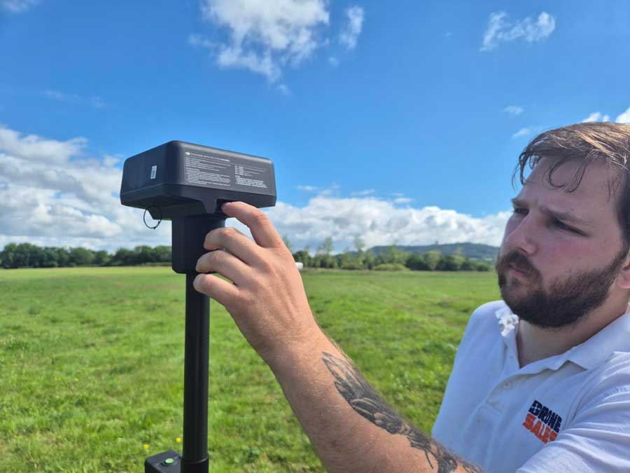
Accurate positioning is an important part of professional drone mapping. The DJI D-RTK 3 Multifunctional Station provides real-time correction data to compatible DJI Enterprise aircraft.
RTK positioning helps improve the geographical consistency of captured imagery and can reduce the number of ground control points required for suitable projects. This is particularly valuable when producing elevation models, repeat surveys, contour plans and datasets that need to align with other site information.
The D-RTK 3 can support base-station and rover workflows, giving surveying and mapping teams greater flexibility when working across different sites.
One Flight Can Create Multiple Commercial Outputs
This project started with a drainage question. The resulting mapping data is now supporting three different areas of work:
- Understanding levels and potential surface-water movement around the lake
- Supporting the wider landscape design using contours and elevation data
- Providing a 3D terrain model for visualising a proposed amphitheatre
For drone operators and surveying businesses, this is an important commercial advantage. A mapping flight does not have to produce only one final deliverable. The same captured dataset can be processed into different outputs for landowners, landscapers, drainage specialists, architects, engineers and contractors.
It allows operators to offer more valuable services while helping their clients make better use of a single site visit.
Build Your Professional Drone Mapping Capability
Drone Sales UK supplies professional DJI Enterprise mapping equipment for photogrammetry, LiDAR, terrain modelling and RTK survey workflows. We can help you choose a system based on your typical sites, required outputs and level of mapping accuracy.
View Matrice 4E View M400 Mapping Package View D-RTK 3