


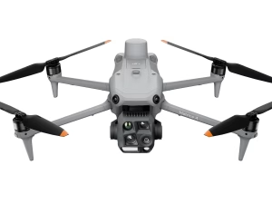
DJI Matrice 4E
£3,940.00
- Up to ~59-minute flight time
- Wide, zoom & laser sensor flexibility
- RTK precision for accurate mapping
- O4 Enterprise transmission system
- Rugged, weather-resistant build
DJI Matrice 4E — Precision Mapping & Inspection for UK Enterprise Teams
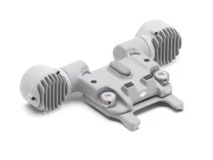
The DJI Matrice 4E is the visible-spectrum specialist in the Matrice 4 Series, purpose-built for high-accuracy mapping, surveying, inspection and engineering workflows. Featuring a 20 MP mechanical-shutter camera, dual 48 MP telephoto sensors, a 3000 m laser rangefinder and O4 Enterprise transmission, the Matrice 4E delivers exceptional data quality in demanding UK conditions.
48 MP Medium Tele
48 MP Tele Camera
3000 m Laser Rangefinder
Up to ~49 min Flight
O4 Enterprise Transmission
RTK Optional

20 MP Mechanical-Shutter Camera for Mapping Accuracy
The Matrice 4E’s primary wide camera is engineered for distortion-free mapping and photogrammetry:
- 20 MP 4/3″ CMOS with mechanical shutter.
- Eliminates rolling-shutter distortion for survey accuracy.
- Fast capture improves mission productivity.
- Ideal for construction, surveying and engineering workflows.
48 MP Medium Tele + 48 MP Tele for High-Detail Inspections
Two high-resolution telephoto cameras support safe and detailed standoff inspections:
- 48 MP Medium Tele — mid-range clarity for asset checks.
- 48 MP Tele — detailed capture of distant structures.
- Perfect for utilities, rail, industrial and infrastructure inspections.
- Stabilised HD feed via O4 Enterprise Transmission.
3–3000 m Laser Rangefinder for Precision Measurement
The LRF provides object distance, size and elevation data instantly — critical for documentation and planning.
- 3–3000 m measurement range.
- Instant target metadata for engineering workflows.
- Enhances repeatability in surveys and inspections.
- Ideal for highway, rail, telecoms and energy sectors.
Extended Flight Time & Enterprise Reliability
The Matrice 4E offers long endurance and rugged reliability for UK field teams:
- Up to ~49 minutes maximum flight time.
- IP-rated weather protection for rain and coastal environments.
- O4 Enterprise connectivity for stable long-range control.
- Hot-swappable batteries for uninterrupted missions.
Example UK Use Cases
Surveying & Mapping
Accurate orthomosaics, land surveys and digital twins.
Inspection & Asset Management
Utilities, rail, telecoms, structures and industrial sites.
Construction & Engineering
Progress tracking, BIM updates and terrain analysis.
DJI Matrice 4E — Frequently Asked Questions
What is the Matrice 4E and how is it different from other Matrice 4 models?
›
Unlike the 4T (thermal) or 4D/M4 Dual (multi-sensor variants), the 4E features a 20 MP mechanical-shutter wide camera
optimised for photogrammetry, plus dual 48 MP telephoto sensors for detailed inspections.
Is the Matrice 4E suitable for professional mapping and surveying in the UK?
›
Its mechanical shutter eliminates rolling-shutter distortion, enabling accurate:
- orthomosaics
- site surveys
- terrain modelling
- construction documentation
With optional RTK, it meets UK-level engineering and land-survey standards.
What industries typically use the Matrice 4E?
›
- Surveying & mapping
- Civil engineering & construction
- Utilities & infrastructure inspections
- Rail & telecoms inspections
- Asset management & condition reporting
It is ideal where high-resolution visible-spectrum imaging is required.
Does the Matrice 4E include a thermal camera?
›
For thermal imaging or fire/SAR workflows, the recommended alternative is the Matrice 4T.
What is the flight time and weather resistance of the Matrice 4E?
›
It also includes IP-rated weather protection, making it suitable for UK rain, coastal conditions, and winter temperatures.
How does the dual-telephoto system improve inspection workflows?
›
- safe standoff imaging from distance
- high-detail capture for utilities and engineering assets
- stabilised HD video feeds over O4 Enterprise
This dramatically reduces risk during hazardous inspections.
Does the Matrice 4E support RTK for survey-grade accuracy?
›
When enabled, it delivers survey-grade georeferencing suitable for:
- BIM workflows
- engineering measurement
- land surveying
- precision mapping
What range does the Matrice 4E operate at, and how reliable is the signal?
›
- urban UK interference conditions
- long-range rural operations
- industrial environments with metal structures
Expect smooth HD feeds and robust command link handling.
What safety systems does the Matrice 4E include?
›
- 360° obstacle sensing with vision + radar fusion
- Smart RTH with terrain & obstacle modelling
- Redundant flight sensors for mission reliability
- Dual-battery power system for operational safety
Can I purchase the Matrice 4E in the UK and do you provide support?
›
- Matrice 4E units & bundles
- RTK modules and accessories
- Training for mapping & inspection teams
- Ongoing UK-based support and servicing
Contact us for availability, quotes or demonstrations.
DJI Matrice 4 Series — In Action
Watch how professionals use the Matrice 4 Series for inspections, mapping, public safety
and remote operations.
DJI Matrice 4E — Technical Specifications
Enterprise-grade mapping and inspection drone engineered for high-accuracy visible-spectrum workflows,
mechanical-shutter photogrammetry and long-range standoff inspections.
48 MP Medium Tele
48 MP Tele Camera
3000 m Laser Rangefinder
Up to ~49 min Flight
O4 Enterprise Transmission
RTK Optional
Aircraft Specifications
- Dimensions (Folded): Approx. 470 × 411 × 230 mm
- Dimensions (Unfolded): Approx. 975 × 680 × 250 mm
- Diagonal Wheelbase: ~830 mm
- Max Take-Off Weight: ~1.4 kg (configuration dependent)
- Max Flight Time: Up to ~49 minutes (no wind)
- Max Wind Resistance: ~12 m/s
- Max Transmission Distance: Up to 20 km (region dependent)
- Ingress Protection: IP-rated weather resistance
- Operating Temperature: –20°C to 50°C
Camera System — Wide + Dual Tele
- Wide Camera (Primary): 20 MP, 4/3″ CMOS, Mechanical Shutter
- Shutter Type: Mechanical (global exposure)
- Resolution: 5280 × 3956
- Medium Tele: 48 MP, 1/1.3″ CMOS
- Tele Camera: 48 MP, 1/2″ CMOS
- Zoom Capability: Up to hybrid telephoto inspection levels
- Video Transmission: O4 Enterprise HD
- Picture Accuracy: High-precision photogrammetry with RTK
Laser Rangefinder
- Measurement Range: 3–3000 m
- Measurement Accuracy: High-precision digital telemetry
- Metadata Output: Distance, size, elevation
- Ideal for engineering surveys, construction modelling and asset inspection.
Transmission & Positioning
- Transmission System: DJI O4 Enterprise
- Max Range: Up to 20 km (location dependent)
- RTK Support: Optional high-accuracy positioning
- GNSS: GPS + Galileo + BeiDou + GLONASS
- Redundancy: Dual IMU, multi-sensor fusion
Battery & Power System
- Battery Type: DJI TB-series Intelligent Flight Battery
- Capacity: ~98 Wh (model dependent)
- Hot Swap: Supported
- Charging: AC or multi-battery charging station
- Flight Time: Up to ~49 minutes
Safety, Sensors & Obstacle Avoidance
- Obstacle Sensing: 360° vision + radar fusion
- Downward Auxiliary Light: Supported
- Smart RTH: with obstacle + terrain modelling
- GNSS Redundancy: Multi-band, multi-satellite
- AirSense ADS-B: Integrated receiver
*Specifications based on typical testing conditions. Performance varies depending on environment, payload,
temperature and mission setup.
DJI Matrice 4E — Camera & Sensor Specifications
Triple-camera system including a 20 MP mechanical-shutter wide camera for photogrammetry,
plus dual 48 MP telephoto cameras and a 3000 m laser rangefinder for precision inspections.
48 MP Medium Tele
48 MP Tele Camera
3000 m LRF
High-Accuracy Mapping
Wide Camera (Primary Mapping Camera)
- Sensor: 4/3″ CMOS
- Effective Pixels: 20 MP
- Shutter Type: Mechanical shutter (ideal for photogrammetry)
- Shutter Speed: 1/2000s – 8s
- Equivalent Focal Length: ~24mm
- Aperture: f/2.8 – f/11
- ISO Range: 100–6400
- Distortion Control: Survey-grade accuracy
- Use Cases: Mapping, surveys, orthomosaics, BIM & digital twins
48 MP Medium Tele Camera
- Sensor: 1/1.3″ CMOS
- Effective Pixels: 48 MP
- Optical Zoom: Mid-range zoom for asset clarity
- Hybrid Zoom: Supports multi-stage hybrid magnification
- Applications: Utilities, telecoms, rail, engineering inspections
48 MP Tele Camera (Long-Range Detail)
- Sensor: 1/2″ CMOS
- Effective Pixels: 48 MP
- Optical Characteristics: High-detail capture at safe distances
- Standoff Inspections: Ideal for towers, pylons, roofs, bridges
- Stabilisation: Fully stabilised via O4 Enterprise video link
Laser Rangefinder (LRF)
- Measurement Range: 3–3000 m
- Accuracy: High-precision distance and elevation readout
- Output Data: Distance, relative height, target position
- Use Cases: Asset planning, engineering modelling, measurement
Video & Imaging Performance
- Transmission: O4 Enterprise HD
- Live Feed: High-resolution, low-latency feed for inspections
- Recording Formats: Standard DJI H.264/H.265 video formats
- Image Enhancement: Real-time sharpening and noise reduction
- Mapping Accuracy: Enhanced with optional RTK stabilisation
*Camera specifications may vary slightly depending on firmware and operational configuration.
Mechanical-shutter mapping performance assumes proper overlap and RTK workflow.
Downloads

Flight management and enterprise operations control interface.
View Recommended Devices
Android 10.0 or later version required.
Samsung Galaxy S22, Samsung Galaxy S10, Samsung Galaxy A54, Samsung Galaxy A53, Redmi Note 12 Pro, Redmi Note 13 Pro, Redmi K60 Pro, HUAWEI nova 12 Pro, HUAWEI HONOR 20I, Xiaomi 13, OPPO Reno10 Pro, OPPO FIND X6, VIVO iQOO 13, VIVO X90, Pixel 7 Pro

SCAN LINK

Windows Installer (ZIP)
macOS Package (PKG)

v3.6.0 • Windows Setup Archive (ZIP)
v1.8 • Developer Library (ZIP)
v1.8 • Developer Library (ZIP)
v17.01.05.16 • Aircraft Firmware (ZIP)
v17.01.05.16 • Aircraft Firmware (ZIP)
v01.64.08.12 • Remote Controller Firmware (ZIP)
v17.00.00.01 • Legacy Aircraft Firmware (ZIP)
v17.00.00.01 • Legacy Aircraft Firmware (ZIP)
v01.64.08.06 • Legacy Remote Controller Firmware (ZIP)
Related Products
-

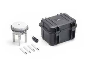
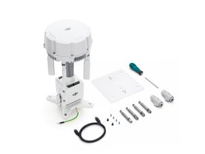
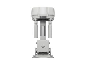
D-RTK 3 Multifunctional Station
£1,369.00 Buy Now -


Matrice 4D Standalone Combo
£5,985.00 Buy Now -

Matrice 4TD Standalone Combo
£7,725.00 Buy Now -


DJI Neo Motion Fly More Combo
£449.00 Read more -
DJI O4 Ground Station
£1,880.00 Buy Now -
Manifold 3
£1,160.00 Buy Now -

DJI Matrice 4T
£5,910.00 Buy Now -

DJI Matrice 4 Series Battery
£159.00 Buy Now -
DJI AL1 Spotlight
£259.00 Buy Now -

DJI AS1 Speaker
£199.00 Buy Now