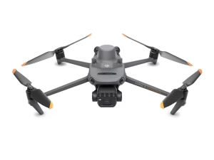
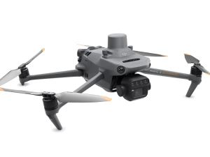
DJI Mavic 3 Multispectral — See More, Grow Smarter
The DJI Mavic 3 Multispectral delivers RGB + multispectral imaging, sunlight sensing, and RTK precision
in a compact, field-ready drone built for UK agriculture and research.
- 43 min flight time · O3 Enterprise transmission (CE 8 km)
- RTK-synced RGB + multispectral data for perfect alignment
- Works with DJI Terra, SmartFarm & agronomy apps
Overview
Comparison
Specifications
FAQ
See Drone