 Skip to content


As drone technology continues to evolve, it’s becoming increasingly important to find equipment that’s not only accurate but also robust enough to handle the practical challenges of mapping in the real world. Whether you’re involved in surveying construction sites, creating topographic maps for agriculture, or working in conservation, the quality of your drone determines the quality of your data—and how reliably you can collect it. In the UK, with its unpredictable weather and varied terrain, choosing the right mapping drone is about more than just camera specs or flight time. It’s about reliability, integration, and long-term performance.
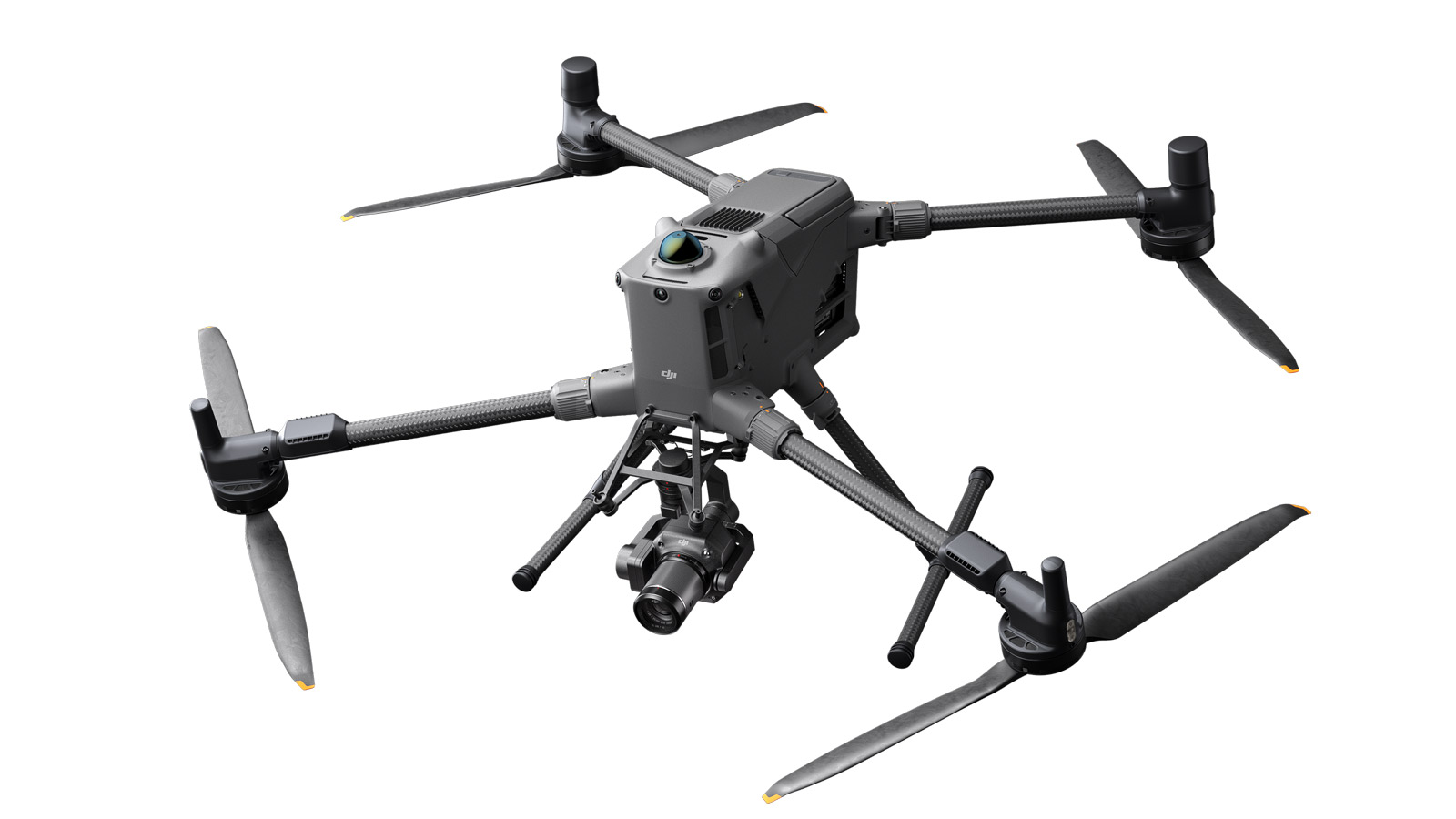
One of the most talked-about platforms in 2026 is the DJI Matrice 400 (M400). As an upgrade from previous Matrice models, the M400 has been designed specifically with commercial and enterprise users in mind. For mapping professionals, this drone offers a powerful combination of durability, payload versatility, and intelligent automation. It’s well-suited to handle the kinds of missions commonly seen across the UK—whether that’s mapping flood zones in Yorkshire, surveying heritage sites in Cornwall, or collecting data on infrastructure projects in the Midlands. The DJI Matrice 400 has quickly become a go-to for organisations that need consistent, high-accuracy results, without compromising on field durability or safety.
What Makes a Drone Truly “Robust” for Mapping?
Robustness is more than just a strong frame. In the context of mapping, it means a drone that can consistently deliver high-quality geospatial data in varied environmental conditions. Here in the UK, that could mean flying in high humidity near the coast, managing battery performance in colder Scottish regions, or navigating strong winds on open farmland. A truly robust mapping drone must be built for endurance, capable of withstanding minor impacts, and engineered with enough sensor redundancy to operate safely, even in less-than-ideal conditions.
Equally important is resistance to electromagnetic interference, a common challenge when mapping around urban construction or near power lines. Your drone needs to maintain stable GPS lock and accurate IMU calibration to ensure georeferenced data remains precise. A robust mapping drone also features weather-resistant builds, quick-swap batteries, and modular payload options—all features that reduce downtime and help surveyors meet tight deadlines, even when the conditions are far from perfect.
Payload Flexibility and Sensor Integration
For mapping professionals, the heart of any drone system is the payload. This includes cameras, LiDAR units, multispectral sensors, or thermal imaging tools—depending on the use case. A robust drone must allow seamless integration of these payloads without compromising stability or battery performance. The DJI Matrice 400 (M400), for instance, supports a wide array of high-end sensors, including the Zenmuse L2 LiDAR and P1 photogrammetry camera. This level of compatibility allows users to switch quickly between missions, whether they need dense point cloud data or high-resolution orthomosaics.
In the UK, this flexibility is crucial. A conservationist mapping peat bogs in the Lake District might need a multispectral camera one day and a photogrammetry payload the next. A surveyor working on a flood plain project in Somerset may need to combine RGB imaging with terrain-following LiDAR. The ability to adapt the same platform across multiple types of missions not only reduces equipment costs but also simplifies training and fleet management.
Flight Time and Coverage Area
One of the major bottlenecks in aerial mapping is battery life. Longer flight times allow for more data to be captured in a single mission, which improves efficiency and reduces stitching errors in post-processing. The DJI Matrice 400, for example, can offer impressive flight times even when carrying heavy payloads, making it ideal for large-scale mapping projects that would otherwise require multiple take-offs and landings. This translates into faster workflows and more consistent data quality across wider coverage areas.
Flight planning is a big part of mapping success, especially in the UK where daylight hours can be limited in winter months. A drone that can stay in the air longer reduces logistical complexity and helps ensure projects are completed within short weather windows. This is especially beneficial for contract surveyors who need to hit multiple sites in a day or capture time-sensitive data during construction progress surveys.
Stability and GNSS Precision in Challenging UK Conditions
Stability is everything when capturing mapping data. Inconsistent positioning or altitude variation can throw off photogrammetry accuracy or distort LiDAR point clouds. A drone designed for professional mapping must maintain a steady, reliable flight path, especially when operating in the wind-prone conditions commonly experienced across the British Isles. This is where advanced flight control systems and GNSS redundancy become vital.
The DJI Matrice 400 leverages multi-band GNSS for enhanced positional accuracy, including support for RTK (Real-Time Kinematic) and PPK (Post-Processed Kinematic) workflows. These technologies ensure that the drone’s position data is accurate down to the centimetre, which is essential for high-precision mapping applications such as volume calculations, linework extraction, or CAD-based planning. When flying in areas with poor satellite visibility—such as between tall buildings or in heavily wooded environments—the drone’s ability to maintain lock and correct its course automatically becomes an indispensable feature.
Ease of Use and Workflow Integration
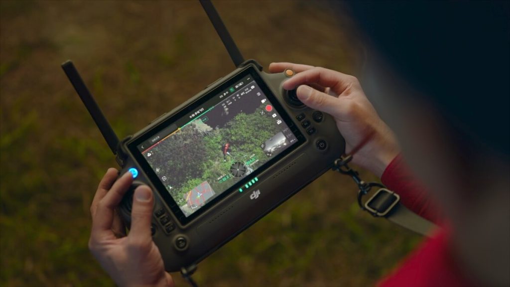
A powerful mapping drone must also be easy to use. Complex setup procedures or clunky software can slow down field operations, introduce human error, and reduce confidence—especially among less experienced team members. In the UK, where mapping professionals may be working under pressure or in rapidly changing weather, quick deployment and intuitive control are critical.
DJI has made notable strides in simplifying enterprise-level drones, and the Matrice 400 is no exception. With its intelligent mission planning software, terrain awareness, and one-touch flight path automation, users can generate repeatable, precise mapping missions with minimal manual input. Features like Smart Oblique Capture and automated take-off/landing sequences reduce pilot workload while ensuring consistency across data sets. This allows even small teams to deliver professional-grade results without the need for an in-house UAV specialist.

Mapping in Rural and Remote Locations
Many mapping projects in the UK take place far from major infrastructure. Whether you’re working along a coastal erosion site in Norfolk or surveying a woodland restoration project in the Cairngorms, your drone needs to be self-reliant. That means rugged build quality, long-range transmission, reliable battery systems, and support for offline mission planning.
The DJI Matrice 400 supports O3 Enterprise transmission, offering robust video and data links at extended ranges—even in areas with patchy mobile coverage. Combined with hot-swappable batteries and IP-rated components, this makes the M400 one of the most dependable options for mapping work in remote UK regions. With the right support equipment, such as portable charging stations and ground control systems, field teams can operate for full days without returning to base.
Software Ecosystems and Data Compatibility
Choosing a robust drone for mapping also involves looking beyond the aircraft itself. It’s about ensuring compatibility with the rest of your mapping workflow, from ground control systems to post-processing software. DJI has invested heavily in making its drones compatible with industry-standard platforms like Pix4D, DroneDeploy, and ESRI, while also developing its own robust software ecosystem with DJI Terra and FlightHub.
This seamless integration allows for faster data processing, better visualisation, and easier handoff to clients or project stakeholders. Whether you’re generating DSMs for environmental analysis, creating contour maps for planning applications, or producing high-resolution orthomosaics for real estate development, a robust mapping drone should support flexible outputs. With the Matrice 400, data captured in the field transitions smoothly into actionable insights in the office, thanks to high-quality metadata and accurate georeferencing.
Maintenance, Support, and Longevity
Investing in a drone for mapping is a long-term commitment, so durability and serviceability matter. UK-based pilots need access to parts, repairs, and software support that can keep them in the air throughout the year. The DJI Matrice 400 benefits from DJI’s global support infrastructure, as well as local dealers and certified repair centres throughout the UK.
Routine maintenance is simplified through modular design and onboard diagnostics, which help identify issues before they result in mission failure. For organisations running fleets of drones across multiple projects, this kind of reliability and support is key to keeping operations efficient and predictable. Knowing your equipment will perform reliably and that help is close at hand adds peace of mind—especially for businesses working to tight client schedules.
The Future of Mapping Drones in the UK
As mapping demands continue to grow, the need for robust, flexible drones will only increase. With climate change, infrastructure expansion, and environmental conservation all driving the need for better geospatial data, drone mapping is becoming an integral part of many UK industries. From local councils conducting land assessments to private firms planning major developments, drone technology is now a standard part of the surveyor’s toolkit.
The DJI Matrice 400 is well-positioned to lead this next generation of mapping tools. With its industrial build, advanced payload compatibility, and intelligent flight systems, it offers the performance and reliability needed to meet the UK’s unique challenges. For businesses and public sector teams alike, investing in a drone like the M400 is not just about adopting new technology—it’s about future-proofing their mapping capabilities.
Final Thoughts
Finding a robust drone for mapping is not simply a matter of picking the model with the longest flight time or the sharpest camera. It’s about evaluating how the drone fits into your specific environment, your mission requirements, and your long-term goals. In the UK, that means dealing with variable weather, compliance with CAA regulations, and diverse mapping needs across both urban and rural settings.
The DJI Matrice 400 stands out as a strong contender for those looking for a reliable, professional-grade mapping platform. It’s a drone built not only to fly—but to perform, adapt, and endure. Whether you’re just entering the world of drone-based mapping or upgrading to a more capable fleet, finding the right drone is the first step in unlocking better data, smoother operations, and stronger outcomes.
If you’re looking for advice on integrating the M400 into your workflow or comparing it with other mapping solutions, feel free to get in touch. We’re always happy to help UK-based professionals find the right tools to get the job done right—first time, every time.