


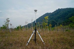
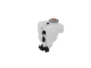
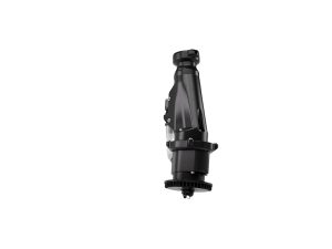
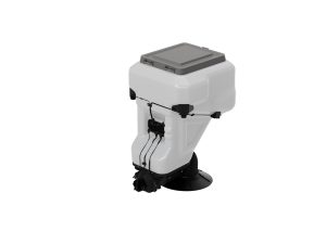
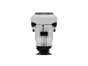
D-RTK 3 Multifunctional Station Agri Bundle
£979.00
- Centimetre-level RTK farm accuracy
- Powers Mavic 3M & Agras missions
- Use as Base, Rover or Relay
- IP67 weather-sealed, long battery life
- Consistent, repeatable survey results
D-RTK 3 Multifunctional Station — RTK for UK Agriculture & Multispectral Mapping
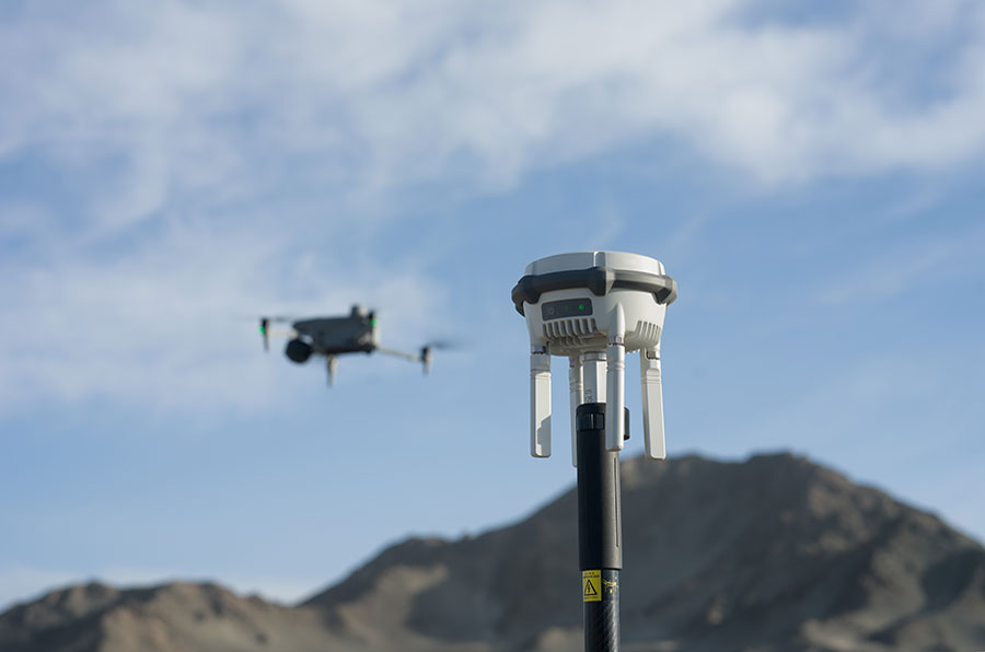
The D-RTK 3 Multifunctional Station is DJI’s field RTK base/rover/relay that delivers
centimetre-level positioning for Mavic 3 Multispectral (M3M) crop surveys and
DJI Agras spraying/spreading missions. Use it to capture accurately geotagged imagery, repeat routes
across seasons, and tighten boundaries and headlands when operating in rural areas with patchy mobile coverage.
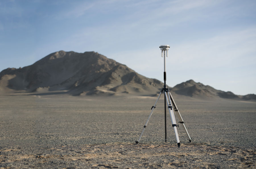
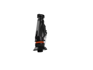
Base Station (Field RTK)
Broadcasts RTK corrections to supported DJI aircraft for on-the-spot cm-level positioning during mapping and operations.
Rover (GCPs & Check Points)
Use on a survey pole to collect ground control/check points for QA and PPK—ideal when you want audit trails or absolute accuracy.
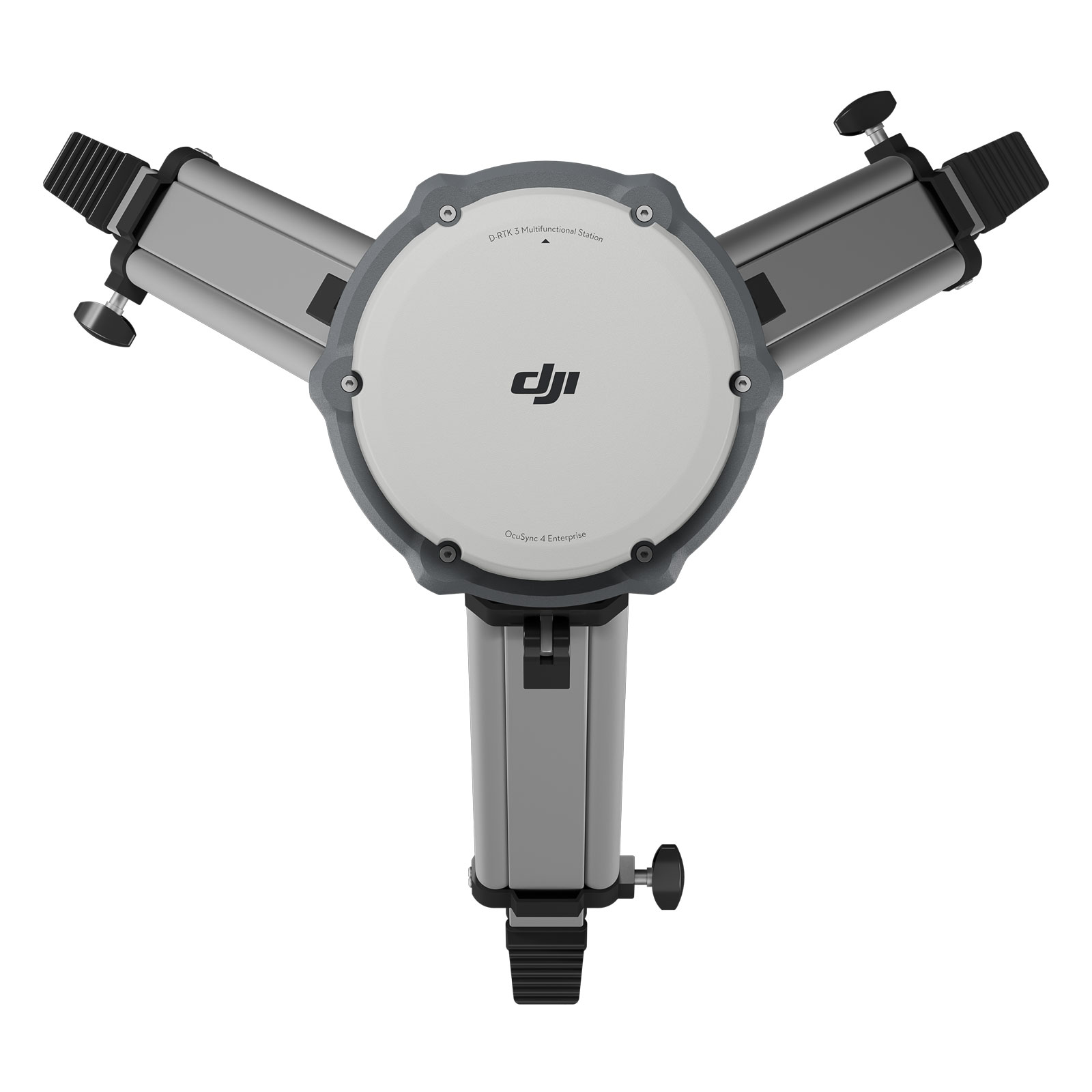
Relay (Signal Bypass)
Mount high (yard mast or field edge) to help overcome hedges/buildings and keep links robust during missions.
Why it matters on UK farms
- Reliable accuracy without NTRIP: Run your own base when mobile data is weak or unavailable, keeping surveys and spray lines on spec.
- Better agronomy decisions: Cm-grade geotags improve index consistency (NDVI/NDRE) and variability analysis for Mavic 3M.
- Repeatable operations: Re-fly boundaries, tramlines and headlands precisely—useful for Agras spraying/spreading season to season.
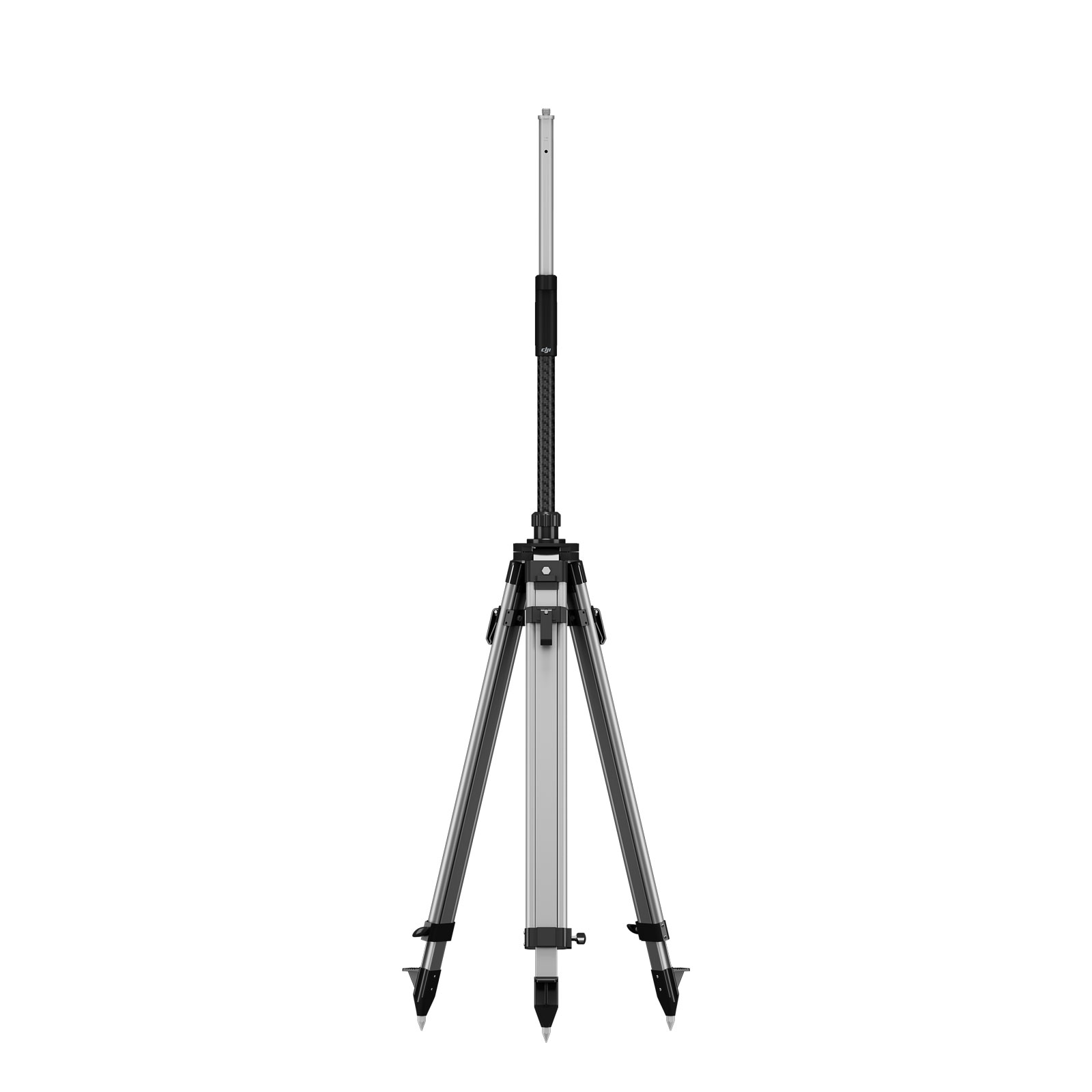
- Fast to deploy: Tripod/pole kit with quick height lock; USB-C PD charging for easy power on farm or in the yard.
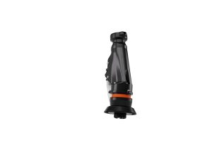
At-a-glance highlights
- Multi-mode: Base, Rover, or Relay in one unit.
- Rugged build: Weather-sealed to IP67 with operating range around −20 °C to 55 °C (field station).
- Endurance: Up to ~7 hrs (Base), ~10 hrs (Rover), ~4 hrs (Relay) per charge.
- Tight ecosystem: Works with Mavic 3 Enterprise series (incl. M3M) and Agras workflows via DJI Pilot 2 / Enterprise App.
Does DJI D‑RTK 3 work with the Mavic 3 Multispectral (M3M)?›
Yes. Use D‑RTK 3 as a local RTK base with the Mavic 3 Multispectral via the Enterprise (Pilot 2) workflow. It delivers centimetre-level positioning for crop mapping and scouting.
Is D‑RTK 3 useful for DJI Agras spraying or spreading (for example T50, T40, T25)?›
Yes. A local base improves boundary accuracy, repeatable headlands and line tracking across seasons, especially where mobile data for NTRIP is weak or unavailable.
Do I still need NTRIP if I buy D‑RTK 3?›
No — D‑RTK 3 replaces the need for network corrections on sites with poor data coverage. If you have reliable 4G or 5G signal then NTRIP remains a simple option. Many UK farms keep D‑RTK 3 for no‑signal areas and repeatable local control.
How accurate is it for farm or field mapping?›
With a good sky view and stable corrections, expect centimetre‑level horizontal accuracy. Always validate with a few check points for survey sheet or compliance work.
Do I still need ground control points (GCPs)?›
For most agronomy tasks RTK plus a few check points is sufficient. For survey‑grade deliverables or audits you should still use GCPs or check points per your specification.
What’s the best way to set up D‑RTK 3 in a field?›
Mount on a tripod or survey pole over firm level ground with a clear sky view. Avoid metal roofs, dense tree canopies and tall hedges that may cause signal reflection or multipath. Record the antenna height and keep the setup stable during flights.
How do I enter coordinates — known point or “survey‑in”?›
Use a known control point when available (fastest and most repeatable). Otherwise use the built‑in survey‑in/average method in the Enterprise app to initialise the base before mission start.
Can one D‑RTK 3 serve multiple drones?›
Yes. A single base can provide corrections to multiple supported DJI aircraft within range and line of sight. Plan your airspace and task timing accordingly.
What is the runtime and how do I power it all day?›
Battery endurance varies by mode. Many users pair it with a vehicle or generator at the headland for long days. Ensure you carry a USB‑C PD supply or backup if the base will run many hours in the field.
Is D‑RTK 3 weather‑proof for UK conditions?›
The unit is weather sealed (IP67) and built for outdoor use. Still avoid immersion and wipe off after heavy rain or dusty conditions. Keep ports capped when not in use.
Does D‑RTK 3 affect UK CAA rules or reduce VLOS requirements?›
No. RTK improves positioning accuracy but does not change legal regulations. Always maintain visual line of sight and operate within your Operational Authorisation and site safety risk assessment.
Which coordinate systems should I use — OSGB36 / BNG or WGS84?›
Drone geotags typically use WGS84. If you need OSGB36/BNG for farm GIS systems convert in DJI Terra or your GIS package. Always keep the base coordinate and antenna height record for transformations.
Can I use D‑RTK 3 as a rover for check points and ground control?›
Yes. It can act as a rover station when mounted on a survey pole, useful for collecting GCPs/check points for QA, trials or regulatory documentation workflows.
What if my fields are surrounded by trees or steep hedgerows?›
Place the base on elevated ground or a clear mound with unobstructed horizon. If signal is poor due to terrain/obstacles, reposition the base or pilot to maintain robust connection and line‑of‑sight.
Will D‑RTK 3 help variable‑rate prescriptions from Mavic 3 Multispectral data?›
Indirectly yes — better absolute and relative positioning reduces boundary or tramline mismatch, improving map alignment and seasonal repeatability, which supports more accurate prescriptions.
What’s included and what else do I need?›
The station ships ready to use; often with a tripod or survey pole mount. Many UK users add a USB‑C PD charger, field power supply, and carry a tripod weight or stake for windy sites.
Any UK‑specific tips before I start mapping or spraying?›
Check airspace/landowner permissions, set clear take‑off and landing areas, brief your crew and capture a short test pass to validate your setup (especially for spray headland lines or boundary runs).
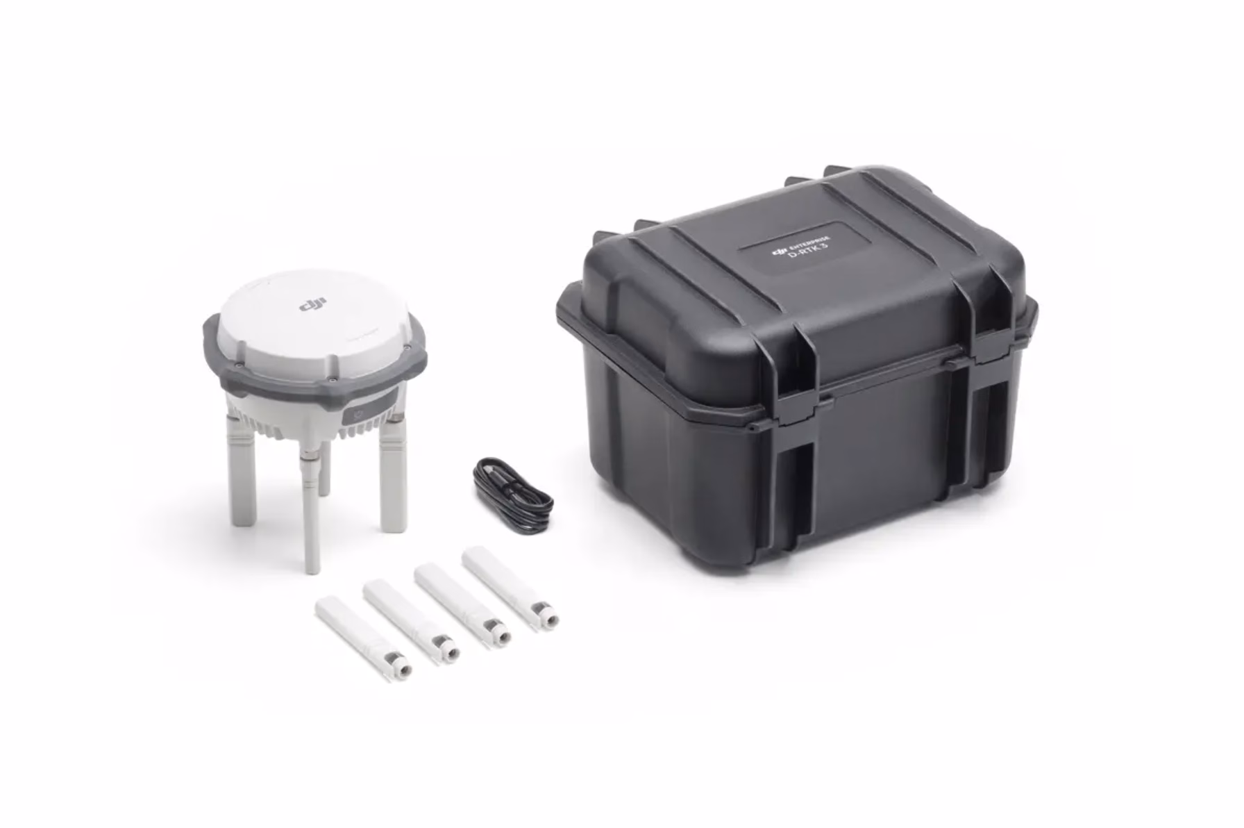
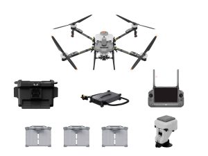
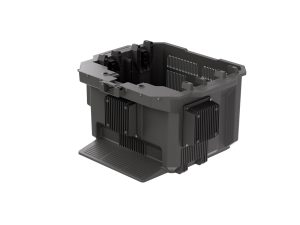
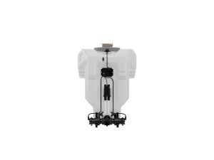
What’s in the Box
DroneSalesUK Agras Tutorial How to Use the DJI Relay
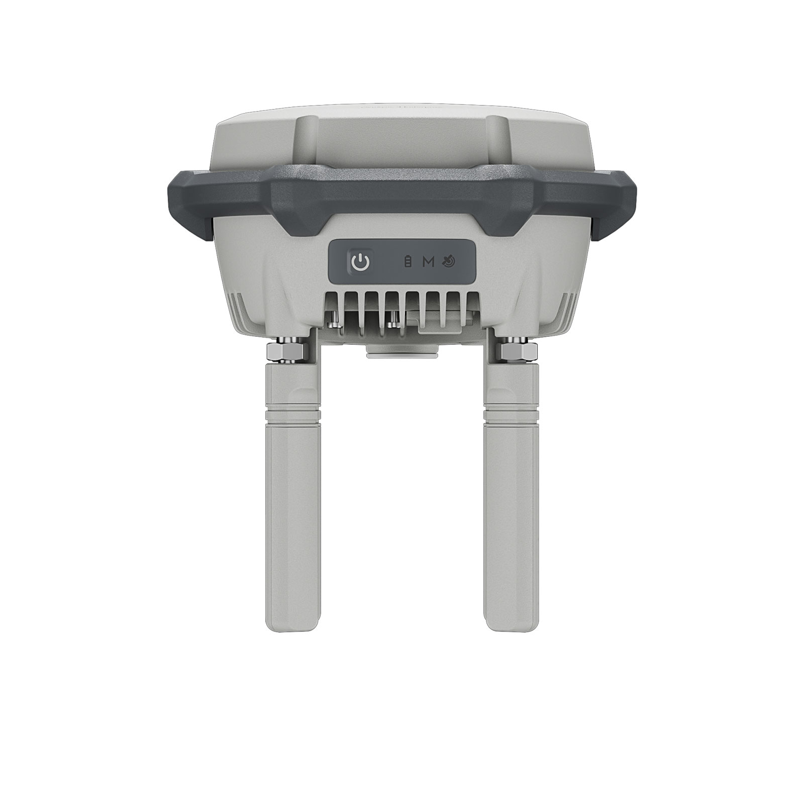
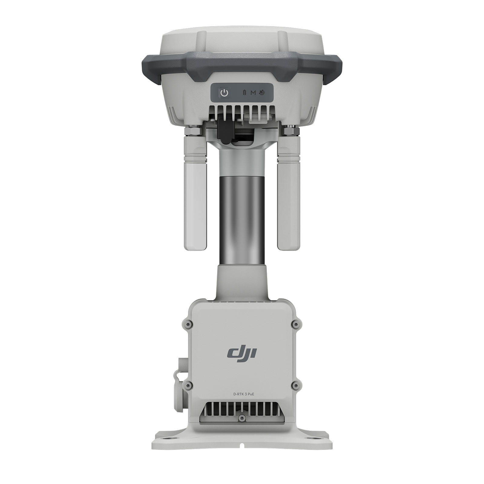
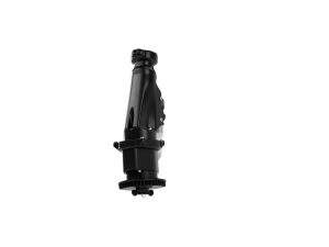
DJI D-RTK 3 — Multifunctional GNSS Base Station
Professional-grade RTK station supporting centimetre-accurate positioning, multi-constellation GNSS, relay functionality, and tilt-enabled mobile surveying. Designed for seamless integration into DJI Enterprise and Agriculture drone workflows.
Centimetre-level accuracy
Multi-constellation GNSS
Up to 10 h battery runtime
Tilt-compensated surveys
IP67 + 2 m drop-tested
Operating Modes
- Base Station (RTK corrections broadcasting)
- Relay Station (range extension for drones)
- Rover Station (tilt-compensated mobile survey)
GNSS & RTK Performance
- Supported Systems: GPS, BeiDou, Galileo, GLONASS, QZSS
- RTK Accuracy (typical static): ~0.8 cm H / ~1.5 cm V + 1 ppm (environment dependent)
- RTK Workflow: Centimetre-level precision with DJI drones; tilt-enabled survey support in Rover mode
Battery & Charging
- Battery Type: Integrated Li-ion ~6,500 mAh
- Runtime: Base ~7 h · Relay ~4 h · Rover ~10 h
- Charging: USB-C PD (9–15 V recommended); supports 5 V USB while powered off
Environmental & Physical
- Operating Temperature: −20 °C to 55 °C
- Altitude Limit: Up to 6,000 m ASL
- Ingress Protection: IP67 (seals fitted); 2 m drop resistance with pole
- Size: ~163 mm (width) × 89 mm (height)
- Weight: ~1.26 kg
Interfaces & Data Formats
- Interfaces: USB-C (for charging/maintenance)
- Relay Variants: May support Ethernet/PoE (model dependent)
- Correction Output: RTCM v3.x (MSM formats)
- Logging: Raw GNSS observation logging in Base/Relay modes
Compatibility & Use-Cases
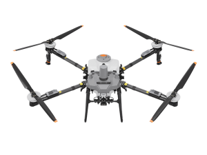
- Aircraft: DJI Mavic 3 Multispectral, Agras series
- Use Cases: Mapping boundaries, spraying headlands, relay placement in blocked/rolling terrain
- What’s Included: D-RTK 3 Unit, OcuSync directional antennas, USB-A to USB-C cable (pole/tripod sold separately)
* GNSS accuracy depends on satellite visibility, corrections signal quality, and local terrain. Comply with spectrum licensing and CAA regulations in your region.
Related Products
-
DJI T70P Fly More Bundle
£26,000.00 Buy Now -


DJI T70 P C12000 Intelligent Power Supply (EMC)
£1,728.00 Buy Now -


DJI T70P Mist Nozzle Package
£585.00 Buy Now -
DB2160 Air-Cooled Heat Sink
£451.00 Buy Now -
DJI AGRAS T70P Propellers
£129.00 Buy Now -
DJI T70 50L Liquid Spray Tank
£450.00 Buy Now -
DJI T70 Atomization Centrifrugal Sprinkler
£650.00 Buy Now -
DJI T70p Water Cooled Mist Sprinklers
£585.00 Buy Now -
DJI T70p Spreading Tank
£1,342.00 Buy Now -


DJI T70P Generator
£4,663.28 Read more