


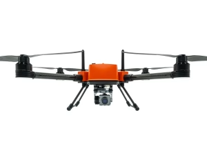
FD2 Sniffer Drone
£22,999.00
- Waterproof drone with gas detection
- Detects multiple gases in real time
- IP67-rated floating airframe
- Supports 2D and 3D gas mapping
- Ideal for industrial inspections
Multi Gas Detection & Mapping Drone System
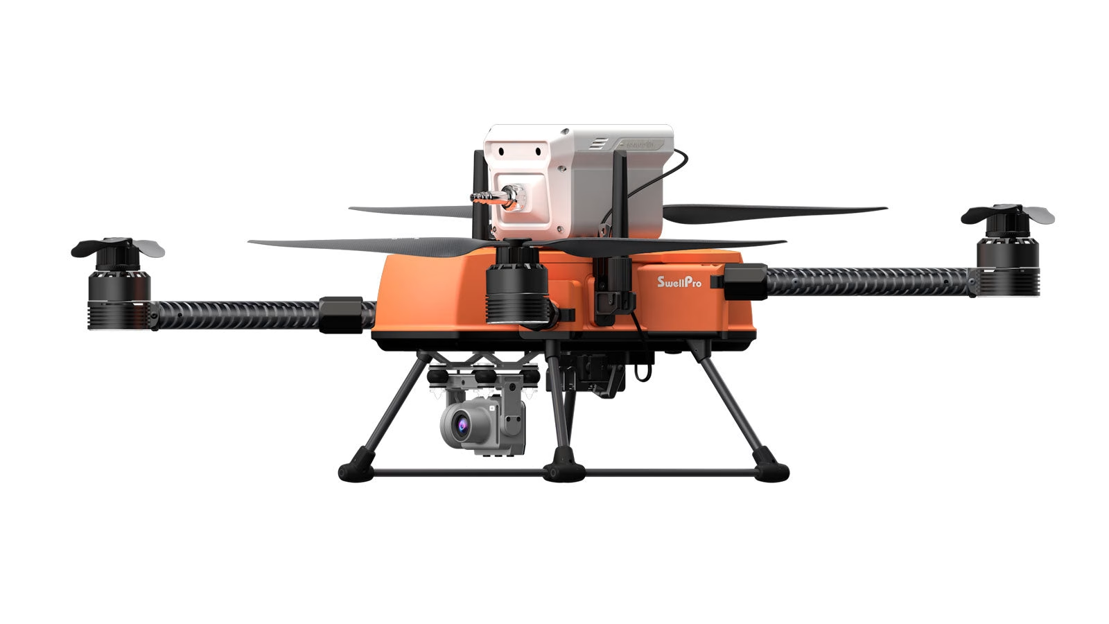
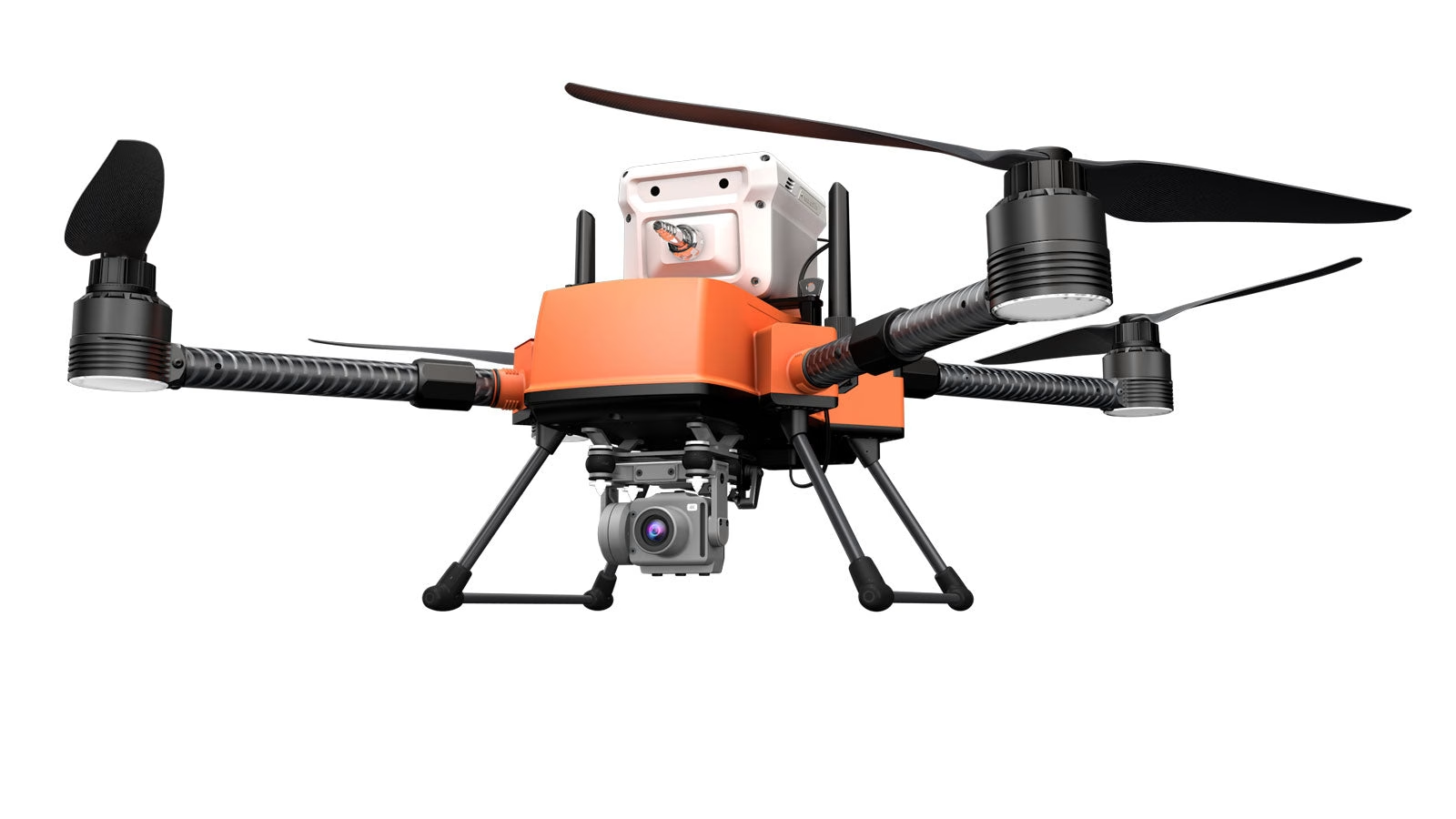
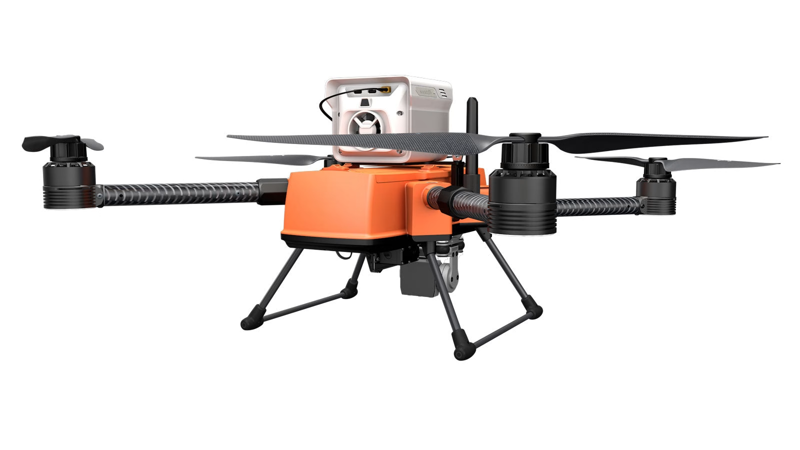
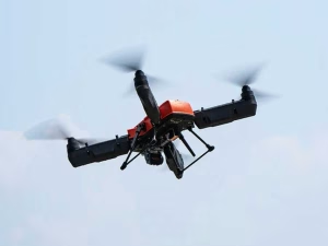
Seamlessly integrated with the Soarability Sniffer4D V2 air quality sensor, the SwellPro FD2 Enterprise drone revolutionises the way we detect and monitor air pollution. This industrial system delivers exceptional reliability, precision, and safety, allowing professionals to quickly locate and map hazardous gas clouds with reduced operational costs and risks.

Simultaneous 9 Gas Detection
3.5KG High Payload Capacity
2D & 3D Real Time Mapping
Level 6 Wind Resistance
Calibration Free System
4G Cloud Data Transmission
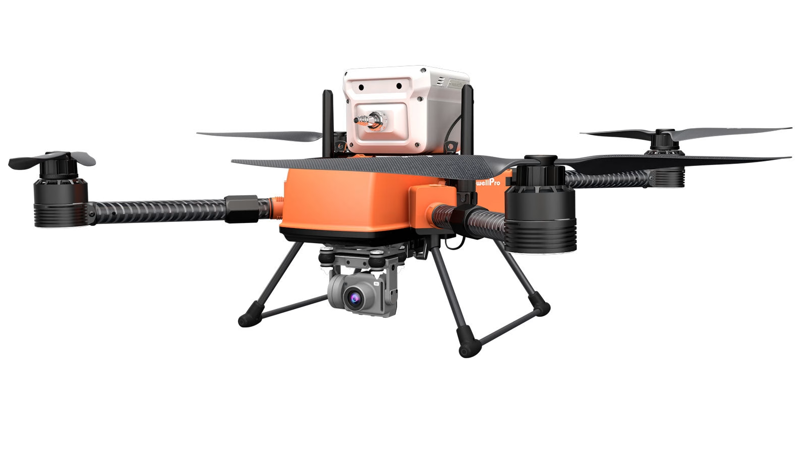
4K Stabilised Gimbal Camera
SwellPro FD2 Enterprise + Sniffer4D V2

Advanced Air Quality Monitoring Capabilities
The FD2 Enterprise Sniffer Drone is a cutting edge solution for comprehensive air quality monitoring. Equipped with the Sniffer4D V2 air quality sensor, it can detect up to nine gases simultaneously, including TVOC, SO₂, CO, NO₂, and O₃. This capability allows for precise measurement of gas concentrations, time, and geographic data, providing a detailed overview of environmental conditions.
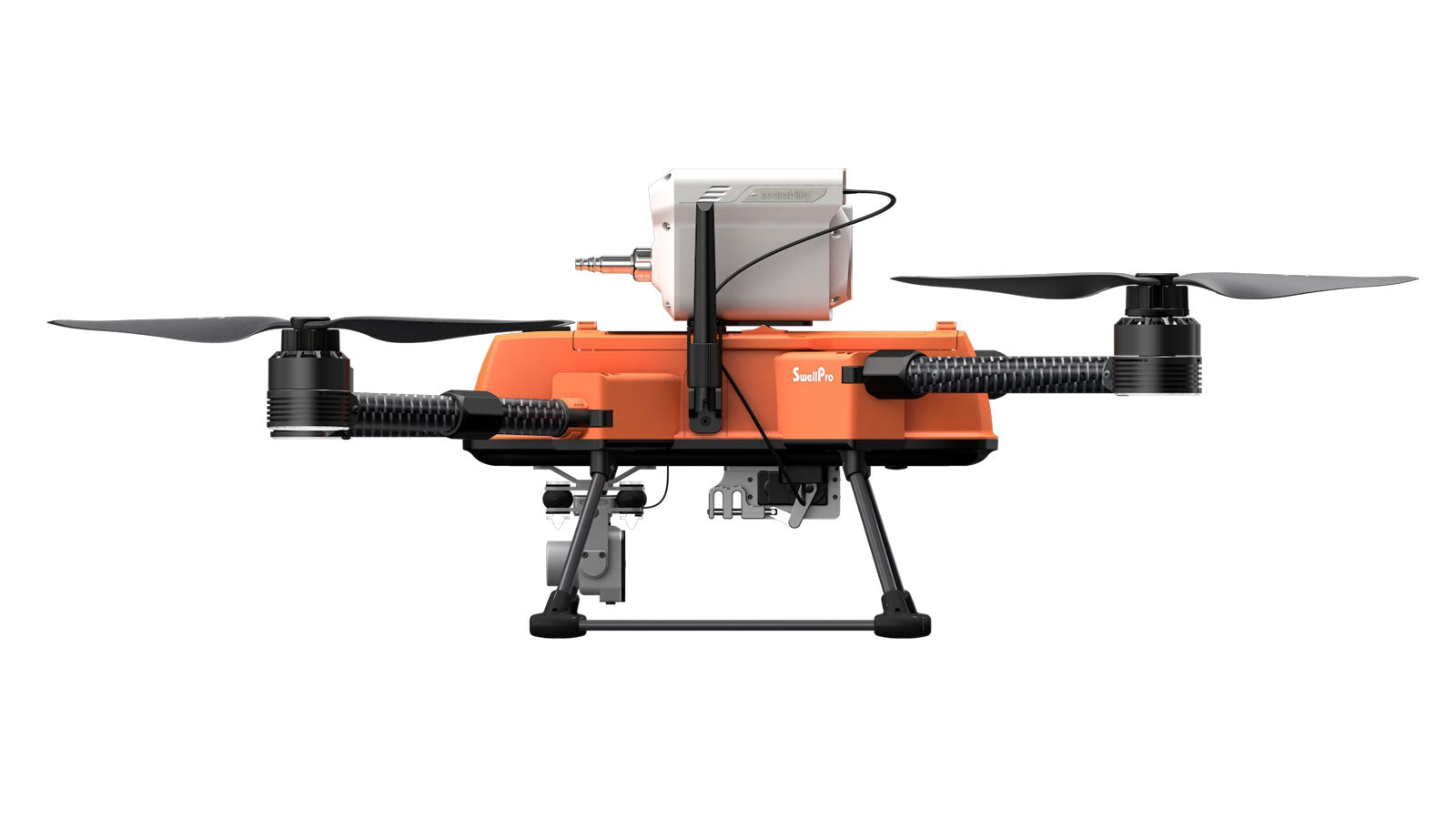
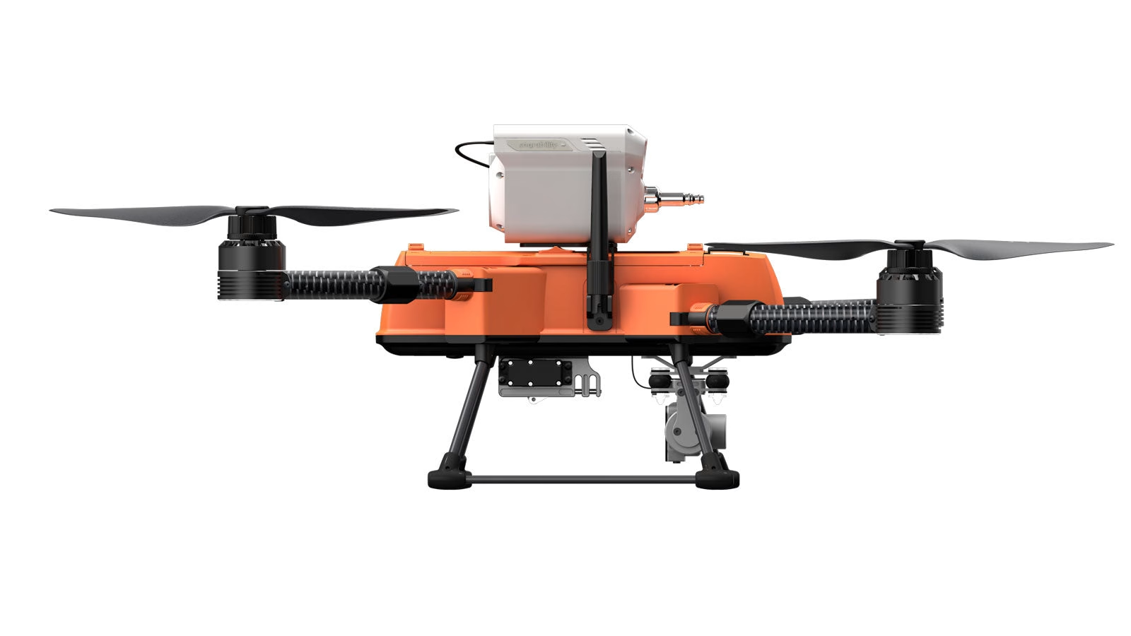
Optimal Flight Architecture
The compact and lightweight design of the Sniffer4D V2 ensures seamless integration with the SwellPro FD2 Enterprise drone, maintaining optimal flight performance without compromising on functionality. This integration enables professionals to conduct thorough air quality assessments efficiently, reducing both costs and risks associated with traditional monitoring methods.
Core System Specifications
SwellPro FD2 Enterprise Drone
- 3.5 KG Payload Capacity: Substantial lift allowance for heavy industrial sensor modules.
- 28 Mins Flight Time: Extended operational window for wide area air sampling.
- IP67 Saltwater proof: Completely sealed fuselage resilient against harsh marine environments.
- 1.5 KM Flight Range: Expansive remote tracking radius for safe observation.
- Level 6 Wind Resistance: Dependable position holding in challenging wind conditions.
- Calibration free: Instant deployment capability without field sensor calibration delays.
- 4K Gimbal Camera: High definition visual confirmation and target tracking during sampling.
- Foldable Design: Compact structural framework for seamless storage and field transport.
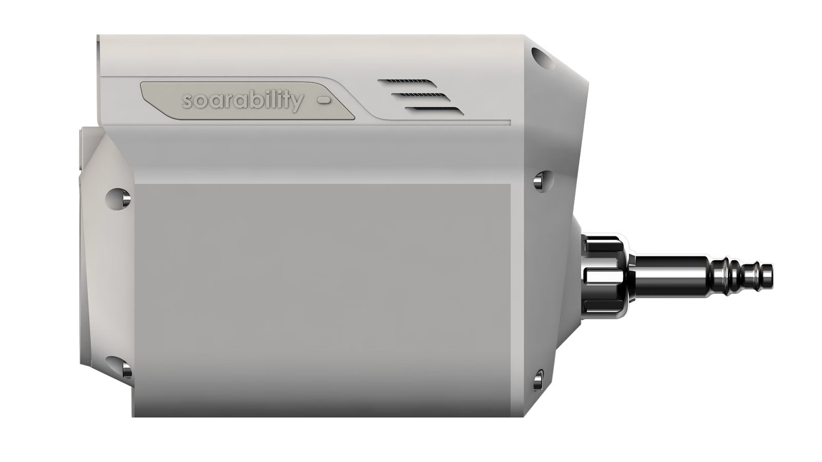
Sniffer4D V2 Multi Gas Sensor
Detects up to 9 gases simultaneously with precise localized data matching. Parameters available include:
SO₂
CO
NO₂
O₃
PM1.0 / PM2.5 / PM10
CxHy / CH₄ / LEL
H₂S
HCl
TSP / PM100
NH₃
CO₂
HCN
H₂
PH₃
Cl₂
O₂
NO
Odor (OU)
High res CH₄
Nuclear Radiation
Wind Speed & Direction
Gas Sampling
One Stop Air Quality Monitoring Solution
Rapid Field Setup
Install the Sniffer4D V2 to the SwellPro FD2 Enterprise drone framework in just a few minutes using a specialized quick release system.
Automated Redundancy
Fly to the desired location and collect pollution tracking values. Systems automatically back up data on the internal SD card for secure post mission analysis.
Cloud Connectivity
Transmit real time telemetry and gas tracking arrays over 4G cellular networks straight to a central cloud management server if a SIM card is configured.
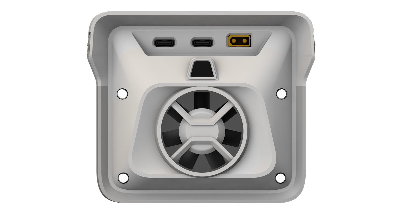
Hardware Integration Layout


Real Time Data Visualisation and Analysis
One of the standout features of the FD2 Enterprise Sniffer Drone is its ability to provide real time data visualisation through the Sniffer4D Mapper software. As the drone collects air pollution data during flight, the software analyses and displays this information instantly in various formats, including 2D grid, 2D isoline, and 3D point cloud maps. This immediate visualization offers professionals intuitive and insightful information, enabling rapid identification of pollution sources and facilitating prompt decision making.
Versatile Industrial Applications
Industrial Emission Monitoring

Enables the tracking, mapping, and recording of industrial stack pollutants, helping organizations remain in full compliance with environmental factory regulations.
Disaster Response Tracking

Provides swift air safety assessments over hazmat hot zones, checking chemical concentrations to protect emergency search response teams and local populations.
Environmental Research

Assists research teams in collecting hyper localized atmospheric gas layers, contributing foundational mapping information toward climate change and community health initiatives.
Oil & Gas Infrastructure

Streamlines structural line inspections by scanning remote pipelines and refinery layouts for volatile organic compounds and invisible methane leaks.
Marine Craft Emissions

Safely samples exhaust smoke directly from ocean vessels inside active shipping ports, verifying low sulphur compliance rules over water surfaces.
Construction Site Safety

Tracks particle dust diffusion and equipment exhaust footprints on active builds, fostering greener construction protocols and protecting neighboring spaces.
Why Buy from Drone Sales UK?
- Authorised UK SwellPro Enterprise & Marine Operations Distributor
- Comprehensive UK hardware configuration & marine aviation regulatory support
- Fast, fully insured UK distribution and dispatch
- Full after sales engineering service, payload adaptation training & localized technical assistance
- Price match guarantee for registered commercial and enterprise clients
What makes the FD2 airframe suitable for industrial gas sniffing?›
The FD2 Enterprise airframe features full IP67 waterproofing and exceptional Level 6 wind resistance (up to 40 mph). This marine-grade build allows environmental teams to safely fly directly into highly corrosive industrial plumes, torrential downpours, or heavy sea spray to scan cargo ship exhaust emissions without risk of short-circuiting.
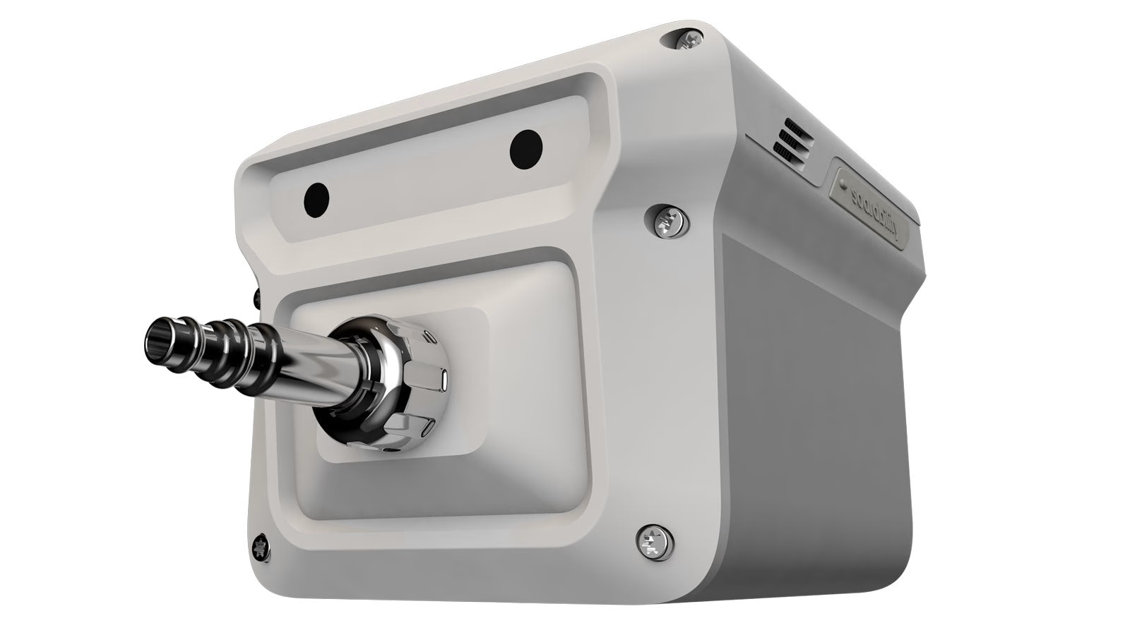
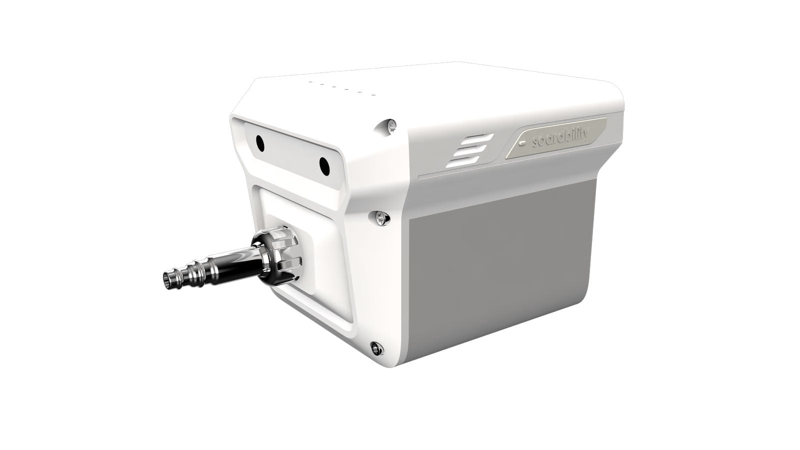
Where is the sniffer module mounted, and why does it matter?›
The Sniffer4D V2 multi-gas module is installed via a specialized top-mounted quick-release rail. Positioning the sensor module on top of the fuselage, well clear of the high-velocity propeller downwash, ensures that ambient air is pulled cleanly into the intake chamber without being mixed or diluted by air pushed downward by the carbon-fibre blades.
Which gases and air pollutants can the system detect simultaneously?›
The system can be configured to track up to nine gases and particulate targets at once. Available ultra-precise sensor options include Carbon Monoxide ($CO$), Carbon Dioxide ($CO_2$), Sulphur Dioxide ($SO_2$), Nitrogen Dioxide ($NO_2$), Hydrogen Sulphide ($H_2S$), Volatile Organic Compounds (TVOCs), Methane ($CH_4$), Ammonia ($NH_3$), and PM2.5/PM10 particulate matter.
How is the gas detection data visualized for ground teams?›
Using the advanced Sniffer4D Mapper software, data is beamed back to control rooms via 4G or high-frequency radio links. The software instantly transforms raw data into 2D grid maps, isoline concentration lines, and 3D point clouds, allowing command teams to see the exact altitude, scale, and origin of a hazardous gas leak in real time.
Can the FD2 Sniffer Drone capture physical air samples for laboratory analysis?›
Yes. In addition to delivering real-time digital readouts, the platform can be optioned with a remote-triggered physical gas sampling pump. When the digital sensors detect a spike or an unknown anomaly in the plume, the pilot can command the drone to fill an on-board Tedlar bag, preserving a pristine sample for laboratory gas chromatography testing.
What is the real-world flight window for environmental mapping shifts?›
Equipped with high-capacity 6S flight packs and carrying the top-mounted sensing payload, the FD2 provides a stable operational flight time of 22 to 25 minutes per cycle. The integrated slide-in battery tray layout allows ground crews to swap packs in under 20 seconds, facilitating swift data collection over large industrial complexes.
Does Drone Sales UK provide custom gas sensor calibration and support?›
Yes. Drone Sales UK provides complete turnkey enterprise configurations. We can pre-load your FD2 platform with specific gas sensor arrays tailored to your exact industry requirement—whether oil & gas pipeline monitoring, landfill compliance, or maritime emissions enforcement—and provide full training and annual sensor recalibration services.
System Demonstration Video
SwellPro FD2 Enterprise Sniffer Drone — Technical Specifications
The ultimate industrial air analysis and environmental monitoring platform. Built upon the rugged, heavy lift Fisherman Max (FD2) Enterprise airframe, this system features seamless integration with the Soarability Sniffer4D V2 multi-gas detection suite to scan, map, and isolate localized air pollution, hazardous gas leaks, and maritime stack emissions in all weather environments.
9 Simultaneous Gas Grid Scans
IP67 Waterproof & Marine Shielded
3D Point Cloud Pollution Mapping
3.5 kg Heavy-Lift Capacity
Real-Time 4G Cloud Telemetry
Air Quality Sensing & Sniffer4D Module
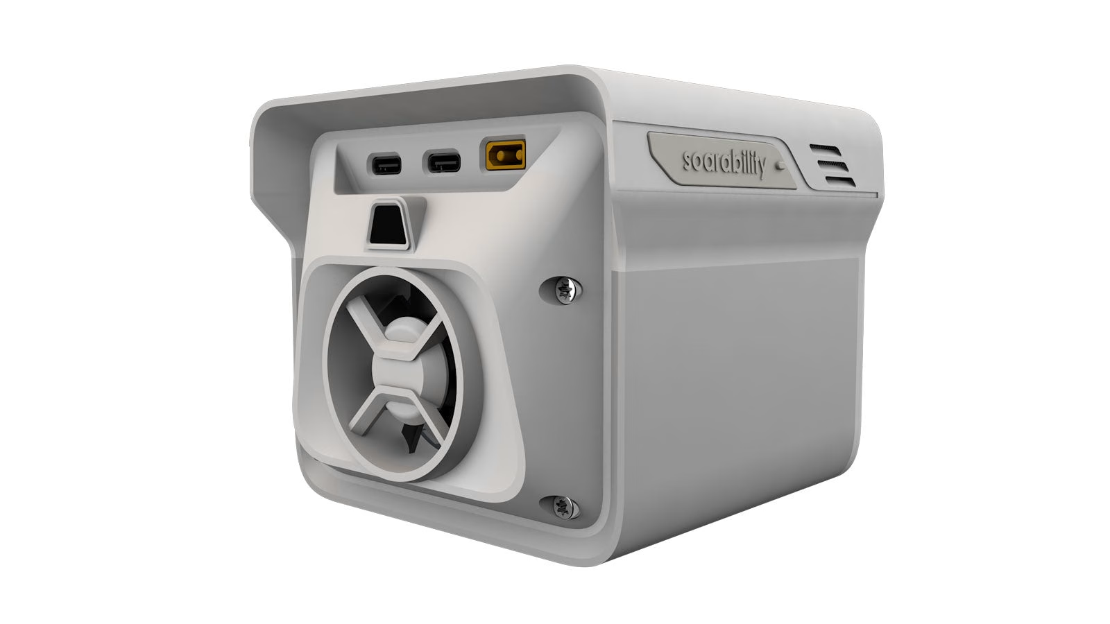
- Sensor Integration: Powered by the Soarability Sniffer4D V2, mounting directly to a top-tier quick-release bracket with a dedicated direct-injection power link.
- Simultaneous Detection: Tracks up to 9 distinct gas concentrations, particulate criteria, or specialized ambient indicators concurrently on a single flight pass.
- Target Gases & Vectors: Configurable for TVOC, SO₂, CO, NO₂, O₃, H₂S, HCl, NH₃, CO₂, HCN, H₂, PH₃, Cl₂, O₂, NO, and high-resolution CH₄ (Methane).
- Particulate Matter Detection: Captures structural density changes across PM1.0, PM2.5, PM10, and TSP/PM100 parameters.
- Advanced Detection Tooling: Supports hardware add-ons for nuclear radiation tracking, localized wind speed/direction profiling, and physical remote gas bottle sampling.
Data Analysis & 3D Cloud Visualization
- Sniffer4D Mapper Engine: Specialized software suite analyzes gathered emission inputs and visualizes them instantly for field operators.
- Reporting Profiles: Projects live air quality metrics using three intuitive processing profiles: 2D geographic grids, 2D concentration isolines, and high-fidelity 3D spatial point clouds.
- Cloud Connectivity: Features an onboard 4G LTE cellular transceiver slot to stream active readings live to off-site command centers while maintaining full post-mission logging on a local internal MicroSD card.
- Core Use Cases: Designed for industrial chimney emission compliance, rapid hazmat disaster response, offshore marine vessel stack auditing, and oil/gas pipeline leak detection.
FD2 Enterprise Flight Platform
- Marine Construction: IP67 dust and saltwater-proof structural hull built with SeaShield anti-corrosion components to navigate chemical fumes, smoke plumes, and oceanic moisture.
- Weight & Form: 3.78 kg standard platform flight weight (including battery). Features rigid carbon fiber arms that fold down from 522×522×192 mm to a compact 306×266×192 mm transit footprint.
- Payload Index: Engineered with a heavy-lift payload margin supporting up to 3.5 kg of total combined sensory equipment.
- Propulsion Setup: High-efficiency #4114 400Kv brushless motors running 40A industrial ESCs and #1655 carbon fiber quick-release propellers.
- Endurance Parameters: Up to 28 minutes of unladen flight time. Maximum horizontal speed clocks 20 m/s (ATTI) or 10 m/s (GPS).
- Wind & Environment Limits: Level 6 wind resistance preserves tracking positions in stiff crosswinds up to 18 m/s (40 mph). Rated for safe operational thermals between -10 °C and 40 °C.
- Avionics & Control: Pre-calibrated multi-band GPS + Galileo receivers eliminate beachside or industrial magnetic compass spin routines. Pairs with an IP54 5-inch touchscreen smart controller pushing a 1.5 km telemetry range.
* Real-world flight endurance will fluctuate based on the specific multi-gas sensor module weight configurations and localized air turbulence. Real-time 4G cloud telemetry requires an active SIM card with sufficient cellular network coverage over the target site. Always ensure the gas intake manifold of the Sniffer4D module is free from dense particulate soot or liquid blockages before launching industrial scanning runs.
Related Products
-

Fisherman Max (FD2)
Price range: £1,999.00 through £3,035.00 Select options This product has multiple variants. The options may be chosen on the product page -
Fisherman Max (FD2) Float System
£99.00 Read more -


Trollsafe
£33.00 Buy Now -


Waterproof Membrane
£21.73 Select options This product has multiple variants. The options may be chosen on the product page -
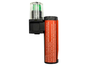
Emergency Buoy
£109.00 Buy Now -
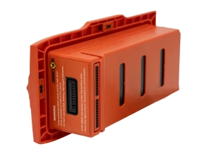
FD2 Battery
£229.00 Buy Now -
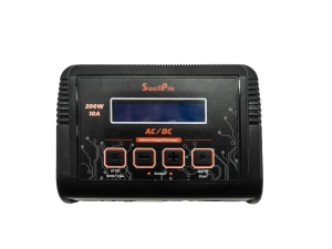
FD2 Battery Charger
£99.00 Read more -
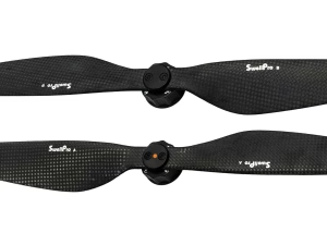
FD2 Propellers
£89.00 Read more -
 Sale!
Sale!

FFD Fish Finder
Original price was: £169.00.£160.55Current price is: £160.55. Buy Now -

Fisherman Controller Sun Shade (FD2/FD3)
£45.00 Read more